Trail Touring skiing Praz-sur-Arly - Tête du Torraz - Photo
 nadd73
nadd73

User

© OpenStreetMap contributors
Length
Length
12.8 km
Max alt
Max alt
1922 m
Uphill gradient
Uphill gradient
911 m
Km-Effort
Km-Effort  
25 km
Min alt
Min alt
1242 m
Downhill gradient
Downhill gradient
914 m
Boucle
Boucle
Yes
Creation date :
2020-12-18 09:23:26.402
Updated on :
2020-12-18 17:15:17.764

(0 Reviews)

Touring skiing
Touring skiing
4h36
Difficulty : Easy

Scan this QR Code to open this trail in the SityTrail application

FREE GPS app for hiking

Logo SityTrail SityTrail

IGN / Geographical institutes

Download SityTrail from the App Store Download SityTrail from Google Play

Logo SityTrail SityTrail World

The world is yours!

Download SityTrail from the App Store Download SityTrail from Google Play Download SityTrail on Huawei AppGallery

About

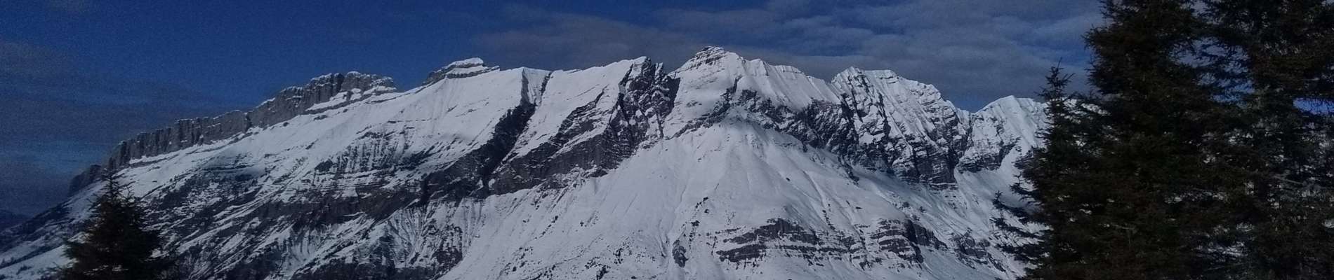
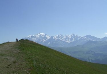
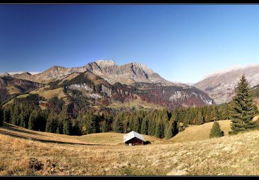
Trail Touring skiing of 12.8 km to be discovered at Auvergne-Rhône-Alpes, Upper Savoy, Praz-sur-Arly. This trail is proposed by nadd73.

Description

Avant Praz sur Arly monter en voiture jusqu'au Mouilles.
Le mieux est de monter au nord du sommet (itinéraire Skieur)

Elevation profile

Photos

Positioning

Country:
France
Region :
Auvergne-Rhône-Alpes
Department/Province :
Upper Savoy
Municipality :
Praz-sur-Arly
Location:
Unknown
Start:(UTM)
310063 ; 5079439 (32T) N.

Trails nearby

Trail Walking Praz-sur-Arly - Balade dans le Val d'Arly - Le Mont de Vorès - Ban Rouge - Le Crêt du Midi - Photo
Walking
tracegps

Walking

Difficult
(1)
Praz-sur-Arly, Auvergne-Rhône-Alpes, Upper Savoy, France
10.2 km | 17.6 km-effort
4h 0min
Yes
Trail Walking Praz-sur-Arly - Balade dans le Val d'Arly - Le Crêt du Midi - Photo
Walking
tracegps

Walking

Difficult
(2)
Praz-sur-Arly, Auvergne-Rhône-Alpes, Upper Savoy, France
11.2 km | 21 km-effort
5h 0min
Yes
Trail Walking La Giettaz - Le Plan - col de Jaillet - Photo
Walking
wbarge

Walking

Medium
(2)
La Giettaz, Auvergne-Rhône-Alpes, Savoy, France
11.9 km | 19.7 km-effort
4h 18min
Yes
Trail Walking La Giettaz - Boucle de Croisse Baulet - Photo
Walking
olivecoco

Walking

Medium
(1)
La Giettaz, Auvergne-Rhône-Alpes, Savoy, France
9.4 km | 23 km-effort
4h 2min
Yes
Trail Other activity La Giettaz - croise baulet - Photo
Other activity
twistss

Other activity

Very easy
(3)
La Giettaz, Auvergne-Rhône-Alpes, Savoy, France
12.1 km | 27 km-effort
3h 30min
Yes
Trail Walking Notre-Dame-de-Bellecombe - NOTRE DAME DE BELLECOMBE - Photo
Walking
albertville

Walking

Very easy
(3)
Notre-Dame-de-Bellecombe, Auvergne-Rhône-Alpes, Savoy, France
13.3 km | 23 km-effort
5h 15min
Yes
Trail Walking Saint-Nicolas-la-Chapelle - Saint Nicolas la Chapelle - Photo
Walking
albertville

Walking

Very easy
(1)
Saint-Nicolas-la-Chapelle, Auvergne-Rhône-Alpes, Savoy, France
9.3 km | 18.2 km-effort
4h 3min
Yes
Trail On foot Megève - Rochebrune - Mègeve - Photo
On foot
PRO

On foot

Easy
Megève, Auvergne-Rhône-Alpes, Upper Savoy, France
5.6 km | 11.9 km-effort
2h 42min
No
Trail Walking Praz-sur-Arly - Tête du Torraz - Photo
Walking
flip38

Walking

Difficult
Praz-sur-Arly, Auvergne-Rhône-Alpes, Upper Savoy, France
18 km | 30 km-effort
6h 6min
Yes


Close
My subscriptions