Trail Walking Loisy - LES HAUTEURS DE LOISY - Le Grand Couronné - Photo

LES HAUTEURS DE LOISY - Le Grand Couronné

© OpenStreetMap contributors
Length
Length
10.5 km
Max alt
Max alt
380 m
Uphill gradient
Uphill gradient
283 m
Km-Effort
Km-Effort  
14.2 km
Min alt
Min alt
184 m
Downhill gradient
Downhill gradient
283 m
Boucle
Boucle
Yes
Creation date :
2020-12-30 13:01:55.53
Updated on :
2020-12-30 18:16:42.046

(0 Reviews)

Walking
Walking
2h42
Difficulty : Easy

Scan this QR Code to open this trail in the SityTrail application

FREE GPS app for hiking

Logo SityTrail SityTrail

IGN / Geographical institutes

Download SityTrail from the App Store Download SityTrail from Google Play

Logo SityTrail SityTrail World

The world is yours!

Download SityTrail from the App Store Download SityTrail from Google Play Download SityTrail on Huawei AppGallery

About

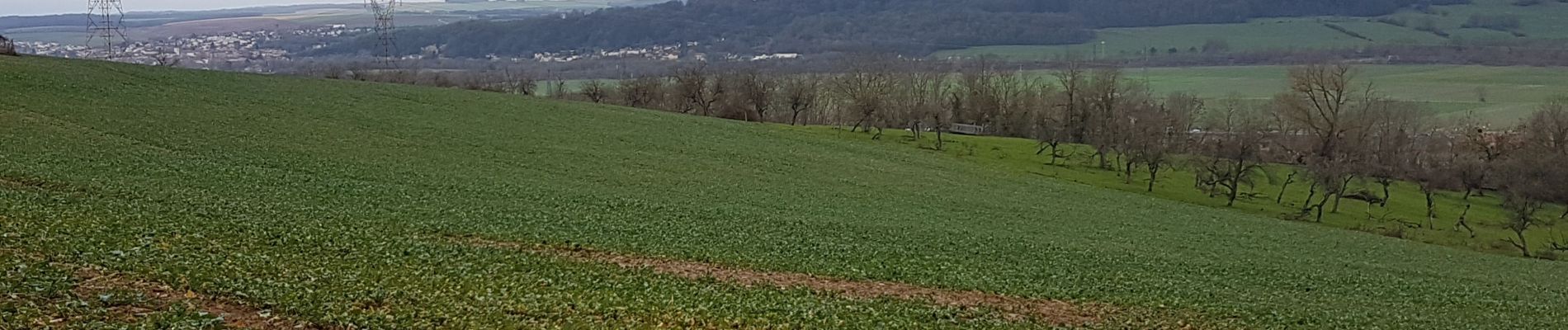
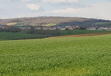
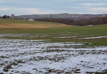
Trail Walking of 10.5 km to be discovered at Grand Est, Meurthe-et-Moselle, Loisy. This trail is proposed by jean-marie.parachini.

Description

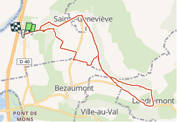
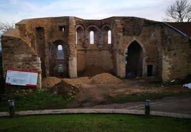
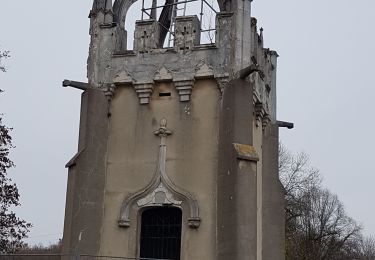
boucle de Loisy vers Landremont et Sainte-Geneviève et retour à Loisy : Parking le Couarail – Grand’rue – tourner à droite – rue de l’église – à la sortie du village, tourner à droite – Grand Sart – Elnonchamps – tourner à droite D10F – le Chaufour – la Côte – tourner à droite vers Landremont – dans Landremont tourner à gauche vers cimetière – vers gîte d’étape – monument du Grand Couronné – Sainte Geneviève – D10C – retour vers Loisy – parking

Elevation profile

Photos

Positioning

Country:
France
Region :
Grand Est
Department/Province :
Meurthe-et-Moselle
Municipality :
Loisy
Location:
Unknown
Start:(UTM)
286975 ; 5416532 (32U) N.

Trails nearby

Trail Cycle Dieulouard - La petite Suisse Lorraine - Circuit n° 11 - Photo
Cycle
tracegps

Cycle

Medium
(1)
Dieulouard, Grand Est, Meurthe-et-Moselle, France
29 km | 35 km-effort
1h 30min
Yes
Trail On foot Sainte-Geneviève - Boucle de la Colline - Photo
On foot
PRO

On foot

Medium
Sainte-Geneviève, Grand Est, Meurthe-et-Moselle, France
15.1 km | 22 km-effort
4h 59min
Yes
Trail Cycle Blénod-lès-Pont-à-Mousson - blenod arnaville xonville gorce blenod - Photo
Cycle
BARAN

Cycle

Very easy
(1)
Blénod-lès-Pont-à-Mousson, Grand Est, Meurthe-et-Moselle, France
85 km | 93 km-effort
Unknown
Yes
Trail Road bike Blénod-lès-Pont-à-Mousson - ST JULIEN GORCE NOVEANT - Photo
Road bike
BARAN

Road bike

Very difficult
(1)
Blénod-lès-Pont-à-Mousson, Grand Est, Meurthe-et-Moselle, France
89 km | 97 km-effort
5h 54min
Yes
Trail Mountain bike Pont-à-Mousson - essai 4 LEVO SL - Photo
Mountain bike
PhilippeC54

Mountain bike

Difficult
Pont-à-Mousson, Grand Est, Meurthe-et-Moselle, France
58 km | 77 km-effort
3h 29min
Yes
Trail Walking Dieulouard - DIEULOUARD - VERS BELLEVILLE ET SAIZERAIS - Photo
Walking
jean-marie.parachini

Walking

Easy
Dieulouard, Grand Est, Meurthe-et-Moselle, France
13.9 km | 16.7 km-effort
4h 43min
Yes
Trail Walking Dieulouard - LA VIERGE DE BELLEVILLE - Photo
Walking
jean-marie.parachini

Walking

Easy
Dieulouard, Grand Est, Meurthe-et-Moselle, France
13.4 km | 16.1 km-effort
3h 19min
Yes
Trail Walking Pont-à-Mousson - Mousson par les remparts - Photo
Walking
jean-marie.parachini

Walking

Very easy
Pont-à-Mousson, Grand Est, Meurthe-et-Moselle, France
4.6 km | 6.8 km-effort
23min
No
Trail Walking Jezainville - NOTRE DAME DES AIRS - Photo
Walking
jean-marie.parachini

Walking

Easy
Jezainville, Grand Est, Meurthe-et-Moselle, France
10.7 km | 13.3 km-effort
2h 36min
Yes


Close
My subscriptions