


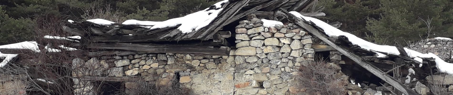
crots les Girars

Sorriaux
User
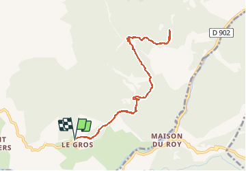

Length
10.2 km

Max alt
1684 m

Uphill gradient
497 m
Km-Effort
16.9 km

Min alt
1389 m

Downhill gradient
496 m
Boucle
Yes
Creation date :
2020-12-17 09:18:33.688
Updated on :
2021-01-11 14:50:54.849
3h41
Difficulty : Medium

FREE GPS app for hiking
 SityTrail
IGN / Geographical institutes
SityTrail Plus
The world is yours!
About
Trail Walking of 10.2 km to be discovered at Provence-Alpes-Côte d'Azur, Hautes-Alpes, Eygliers. This trail is proposed by Sorriaux.
Photos


Positioning
Country:
France
Region :
Provence-Alpes-Côte d'Azur
Department/Province :
Hautes-Alpes
Municipality :
Eygliers
Location:
Unknown
Start:(Dec)
Start:(UTM)
315301 ; 4949671 (32T) N.
Comments