


refuge de la croire-- col de la pierre percée

melsacri
User
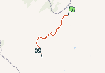

Length
3.8 km

Max alt
2439 m

Uphill gradient
376 m
Km-Effort
7.7 km

Min alt
2076 m

Downhill gradient
17 m
Boucle
No
Creation date :
2021-01-11 09:25:51.248
Updated on :
2021-01-12 19:03:02.692
1h54
Difficulty : Easy

FREE GPS app for hiking
 SityTrail
IGN / Geographical institutes
SityTrail Plus
The world is yours!
About
Trail Touring skiing of 3.8 km to be discovered at Auvergne-Rhône-Alpes, Savoy, Aime-la-Plagne. This trail is proposed by melsacri.
Description
Très belle rando depuis le cormet d areche
Positioning
Country:
France
Region :
Auvergne-Rhône-Alpes
Department/Province :
Savoy
Municipality :
Aime-la-Plagne
Location:
Granier
Start:(Dec)
Start:(UTM)
313491 ; 5054426 (32T) N.
Comments