


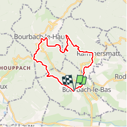
BOURBACH LE BAS -SPANNPLATZ-BOURBACH LE HAUT-COL DU SCHIRM-BOURBACH LE BAS

patrickbeyrath
User

Length
12.5 km

Max alt
672 m

Uphill gradient
467 m
Km-Effort
18.7 km

Min alt
379 m

Downhill gradient
462 m
Boucle
Yes
Creation date :
2018-10-13 05:53:08.854
Updated on :
2018-10-13 05:53:08.868
4h05
Difficulty : Medium

FREE GPS app for hiking
 SityTrail
IGN / Geographical institutes
SityTrail Plus
The world is yours!
About
Trail Walking of 12.5 km to be discovered at Grand Est, Haut-Rhin, Bourbach-le-Bas. This trail is proposed by patrickbeyrath.
Positioning
Country:
France
Region :
Grand Est
Department/Province :
Haut-Rhin
Municipality :
Bourbach-le-Bas
Location:
Unknown
Start:(Dec)
Start:(UTM)
354150 ; 5292894 (32T) N.
Comments