


Vtt Monts de Blond 19 01 2021

topolino
User
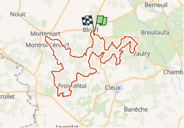

Length
54 km

Max alt
501 m

Uphill gradient
1341 m
Km-Effort
71 km

Min alt
271 m

Downhill gradient
1341 m
Boucle
Yes
Creation date :
2021-01-19 17:20:02.018
Updated on :
2021-01-19 17:23:34.216
4h57
Difficulty : Very difficult

FREE GPS app for hiking
 SityTrail
IGN / Geographical institutes
SityTrail Plus
The world is yours!
About
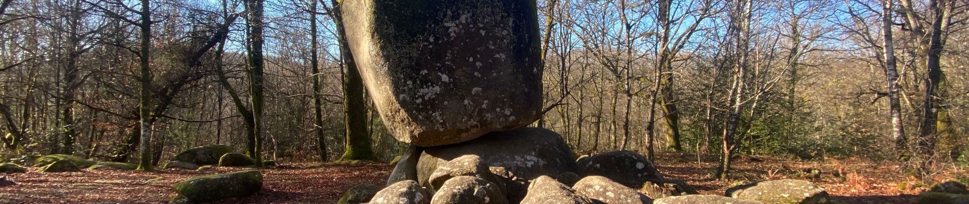
Trail Mountain bike of 54 km to be discovered at New Aquitaine, Haute-Vienne, Blond. This trail is proposed by topolino.
Photos

Positioning
Country:
France
Region :
New Aquitaine
Department/Province :
Haute-Vienne
Municipality :
Blond
Location:
Unknown
Start:(Dec)
Start:(UTM)
347089 ; 5100694 (31T) N.
Comments