


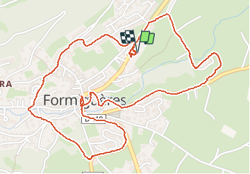
tour de Formigueres

Mascart
User

Length
3.8 km

Max alt
1537 m

Uphill gradient
67 m
Km-Effort
4.7 km

Min alt
1475 m

Downhill gradient
68 m
Boucle
Yes
Creation date :
2021-01-27 09:10:38.012
Updated on :
2021-01-27 10:34:52.819
1h22
Difficulty : Easy

FREE GPS app for hiking
 SityTrail
IGN / Geographical institutes
SityTrail Plus
The world is yours!
About
Trail Walking of 3.8 km to be discovered at Occitania, Pyrénées-Orientales, Formiguères. This trail is proposed by Mascart.
Description
st. épuration
Positioning
Country:
France
Region :
Occitania
Department/Province :
Pyrénées-Orientales
Municipality :
Formiguères
Location:
Unknown
Start:(Dec)
Start:(UTM)
426693 ; 4718583 (31T) N.
Comments