


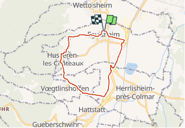
2021 Route Eguisheim Husseren Herrlisheim

staubalex
User

Length
11.7 km

Max alt
388 m

Uphill gradient
220 m
Km-Effort
14.6 km

Min alt
188 m

Downhill gradient
221 m
Boucle
Yes
Creation date :
2021-02-01 14:41:46.897
Updated on :
2021-02-01 14:43:11.17
1h00
Difficulty : Difficult

FREE GPS app for hiking
 SityTrail
IGN / Geographical institutes
SityTrail Plus
The world is yours!
About
Trail Other activity of 11.7 km to be discovered at Grand Est, Haut-Rhin, Eguisheim. This trail is proposed by staubalex.
Positioning
Country:
France
Region :
Grand Est
Department/Province :
Haut-Rhin
Municipality :
Eguisheim
Location:
Unknown
Start:(Dec)
Start:(UTM)
373938 ; 5322814 (32U) N.
Comments