


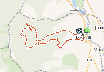

20 km | 33 km-effort


User


FREE GPS app for hiking
 SityTrail
IGN / Geographical institutes
SityTrail World
The world is yours!
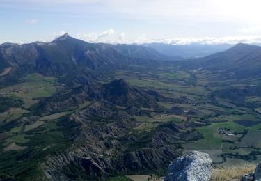
Trail On foot of 9.9 km to be discovered at Provence-Alpes-Côte d'Azur, Hautes-Alpes, Méreuil. This trail is proposed by rigol05.
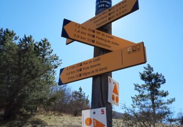
Modification de l'itinéraire "Boucle sous le Rocher de Beaumont". But, éviter les nombreux passages privés interdit d'accès. Les autochtones ne sont pas particulièrement conciliants.

Walking

Walking

Walking
Walking
Walking

Walking
On foot
Walking
Walking