


Randonnées dans les Vosges alsaciennes Jour 3

piem
User
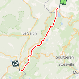

Length
13.9 km

Max alt
1304 m

Uphill gradient
530 m
Km-Effort
21 km

Min alt
1132 m

Downhill gradient
461 m
Boucle
No
Creation date :
2018-04-10 19:24:33.639
Updated on :
2018-04-10 19:24:33.639
4h20
Difficulty : Medium

FREE GPS app for hiking
 SityTrail
IGN / Geographical institutes
SityTrail Plus
The world is yours!
About
Trail Walking of 13.9 km to be discovered at Grand Est, Haut-Rhin, Orbey. This trail is proposed by piem.
Description
Randonnée itinérante de 3 jours avec des enfants (7 et 9 ans) - jour 3 : du Col du Calvaire au refuge du Sotré (Hohneck)
Positioning
Country:
France
Region :
Grand Est
Department/Province :
Haut-Rhin
Municipality :
Orbey
Location:
Unknown
Start:(Dec)
Start:(UTM)
357946 ; 5333100 (32U) N.
Comments