


Lac de la Moucherolle

GOHIER
User

Length
11.6 km

Max alt
1867 m

Uphill gradient
634 m
Km-Effort
21 km

Min alt
1101 m

Downhill gradient
774 m
Boucle
No
Creation date :
2021-02-21 07:57:52.0
Updated on :
2021-02-21 11:50:05.166
3h51
Difficulty : Unknown

FREE GPS app for hiking
 SityTrail
IGN / Geographical institutes
SityTrail Plus
The world is yours!
About
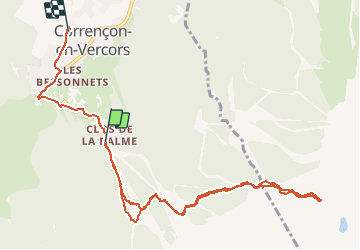
Trail Touring skiing of 11.6 km to be discovered at Auvergne-Rhône-Alpes, Isère, Corrençon-en-Vercors. This trail is proposed by GOHIER.
Description
Avec Sandrine, Bruno et Patricia.
Grand beau mais Vent abominable!
Positioning
Country:
France
Region :
Auvergne-Rhône-Alpes
Department/Province :
Isère
Municipality :
Corrençon-en-Vercors
Location:
Unknown
Start:(Dec)
Start:(UTM)
699297 ; 4988221 (31T) N.
Comments