


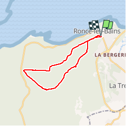
Ronce les bains-La Coubre

Bobol
User

Length
12 km

Max alt
52 m

Uphill gradient
151 m
Km-Effort
14 km

Min alt
6 m

Downhill gradient
145 m
Boucle
Yes
Creation date :
2014-12-10 00:00:00.0
Updated on :
2014-12-10 00:00:00.0
3h02
Difficulty : Easy

FREE GPS app for hiking
 SityTrail
IGN / Geographical institutes
SityTrail Plus
The world is yours!
About
Trail Walking of 12 km to be discovered at New Aquitaine, Charente-Maritime, La Tremblade. This trail is proposed by Bobol.
Description
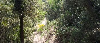
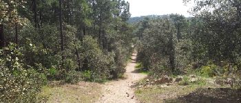
Ballade dans la forêt. Quelques parties du chemins dans du sable (tassé).
Photos


Positioning
Country:
France
Region :
New Aquitaine
Department/Province :
Charente-Maritime
Municipality :
La Tremblade
Location:
Unknown
Start:(Dec)
Start:(UTM)
642856 ; 5072699 (30T) N.
Comments
C'est super ...comme balade...je vais faire bientôt merci pour le partage