


PHR TM Day 44

ARVIEU
User

Length
22 km

Max alt
1247 m

Uphill gradient
792 m
Km-Effort
36 km

Min alt
0 m

Downhill gradient
1742 m
Boucle
No
Creation date :
2021-02-22 14:34:22.329
Updated on :
2021-02-22 14:34:51.705
8h06
Difficulty : Very difficult

FREE GPS app for hiking
 SityTrail
IGN / Geographical institutes
SityTrail Plus
The world is yours!
About
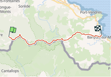
Trail Walking of 22 km to be discovered at Occitania, Pyrénées-Orientales, L'Albère. This trail is proposed by ARVIEU.
Positioning
Country:
France
Region :
Occitania
Department/Province :
Pyrénées-Orientales
Municipality :
L'Albère
Location:
Unknown
Start:(Dec)
Start:(UTM)
493646 ; 4703009 (31T) N.
Comments