


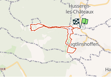
SENTIER DES MOINES MARBACH

jcschubnel
User

Length
7.9 km

Max alt
557 m

Uphill gradient
265 m
Km-Effort
11.4 km

Min alt
352 m

Downhill gradient
265 m
Boucle
Yes
Creation date :
2021-03-08 13:13:24.928
Updated on :
2021-03-08 16:57:33.411
2h21
Difficulty : Very easy

FREE GPS app for hiking
 SityTrail
IGN / Geographical institutes
SityTrail Plus
The world is yours!
About
Trail Walking of 7.9 km to be discovered at Grand Est, Haut-Rhin, Eguisheim. This trail is proposed by jcschubnel.
Positioning
Country:
France
Region :
Grand Est
Department/Province :
Haut-Rhin
Municipality :
Eguisheim
Location:
Unknown
Start:(Dec)
Start:(UTM)
371860 ; 5320664 (32U) N.
Comments