Trail Walking Saint-Antonin-sur-Bayon - Ste Victoire - Le Garagaï - Photo
 ETMU5496
ETMU5496

User

© OpenStreetMap contributors
Length
Length
15.8 km
Max alt
Max alt
909 m
Uphill gradient
Uphill gradient
889 m
Km-Effort
Km-Effort  
28 km
Min alt
Min alt
270 m
Downhill gradient
Downhill gradient
890 m
Boucle
Boucle
Yes
Creation date :
2021-03-10 07:57:52.0
Updated on :
2021-04-26 15:01:07.296

(1 Reviews)

Walking
Walking
4h36
Difficulty : Difficult

Scan this QR Code to open this trail in the SityTrail application

FREE GPS app for hiking

Logo SityTrail SityTrail

IGN / Geographical institutes

Download SityTrail from the App Store Download SityTrail from Google Play

Logo SityTrail SityTrail Plus

The world is yours!

Download SityTrail from the App Store Download SityTrail from Google Play Download SityTrail on Huawei AppGallery

About

Trail Walking of 15.8 km to be discovered at Provence-Alpes-Côte d'Azur, Bouches-du-Rhône, Saint-Antonin-sur-Bayon. This trail is proposed by ETMU5496.

Description

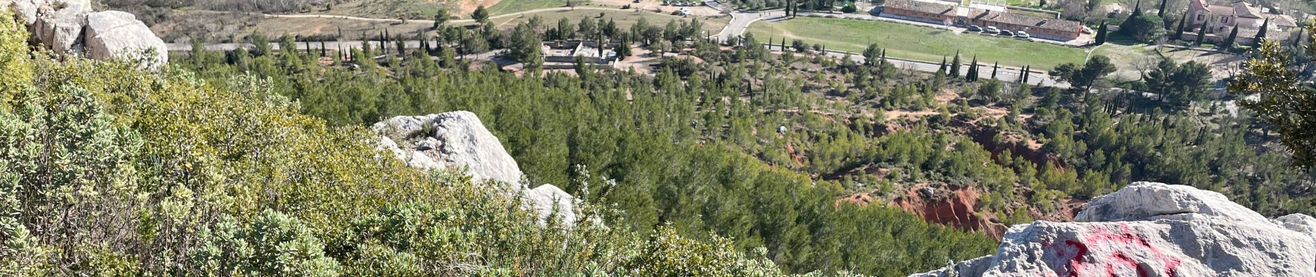
Départ : maison de la Ste Victoire à St Antonin
La Croix de Provence par le sentier noir du  Garagaï.
De la Croix redescente par le sentier bleu de la moucha jusqu'au barrage de Bismont.
Retour par le GR jusqu'au refuge Cezanne. Poursuivre pour se diriger à une bifurcation vers l'oppidum.
Puis redescente au point de départ

Elevation profile

Photos

74 photos in total. Please click on a photo to see them all in the gallery.
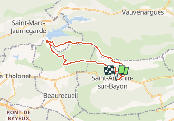
Positioning

Country:
France
Region :
Provence-Alpes-Côte d'Azur
Department/Province :
Bouches-du-Rhône
Municipality :
Saint-Antonin-sur-Bayon
Location:
Unknown
Start:(UTM)
708960 ; 4821712 (31T) N.

Comments

Please log in to post a review or rate the element


Close
My subscriptions