Saint-Antonin-sur-Bayon, Bouches-du-Rhône: Best trails, routes and walks

18 comments

Saint-Antonin-sur-Bayon: Discover the best trails: 198 hiking trails and 4 bike and mountain-bike routes. All these trails, routes and outdoor activities are available in our SityTrail applications for smartphones and tablets.


The best trails (211)

Trail Walking Saint-Antonin-sur-Bayon - Ste Victoire - Le Garagaï - Photo
Walking 15.788
Km

Walking

Difficult
(1)
Saint-Antonin-sur-Bayon, Provence-Alpes-Côte d'Azur, Bouches-du-Rhône, France
15.8 km | 28 km-effort
4h 36min
889 m
890 m
Yes
ETMU5496

Trail Walking Saint-Antonin-sur-Bayon - 2023-02-10 Sainte Victoire Bau des Vespres - Photo
Walking 9.992
Km
GUIDE

Walking

Difficult
Saint-Antonin-sur-Bayon, Provence-Alpes-Côte d'Azur, Bouches-du-Rhône, France
10 km | 18.8 km-effort
3h 30min
658 m
659 m
Yes
Kargil

Trail Walking Saint-Antonin-sur-Bayon - pas du clapier et tracé vert - Photo
Walking 10.52
Km
GUIDE

Walking

Difficult
Saint-Antonin-sur-Bayon, Provence-Alpes-Côte d'Azur, Bouches-du-Rhône, France
10.5 km | 21 km-effort
5h 24min
781 m
781 m
Yes
amiral13

Trail Walking Saint-Antonin-sur-Bayon - Sainte Victoire - Bau Cézanne - tracé jaune - Photo
Walking 5.337
Km
GUIDE

Walking

Difficult
(1)
Saint-Antonin-sur-Bayon, Provence-Alpes-Côte d'Azur, Bouches-du-Rhône, France
5.3 km | 12.2 km-effort
2h 28min
518 m
519 m
Yes
amiral13

Trail Walking Saint-Antonin-sur-Bayon - Sommet Croix de Provence - Barrage du Bimont - Photo
Walking 14.225
Km
GUIDE

Walking

Medium
Saint-Antonin-sur-Bayon, Provence-Alpes-Côte d'Azur, Bouches-du-Rhône, France
14.2 km | 25 km-effort
5h 3min
826 m
825 m
Yes
lhomme.ph

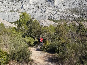
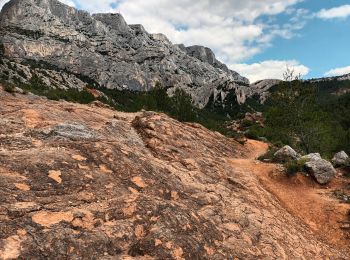
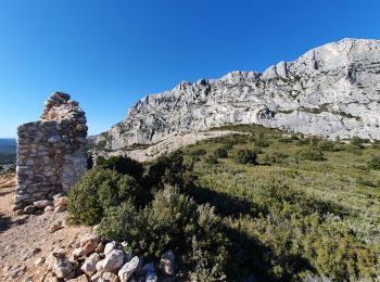
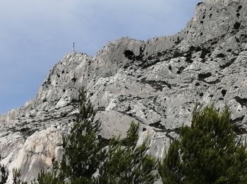
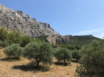
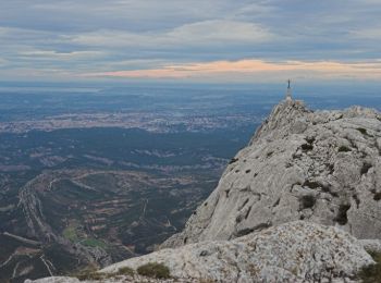
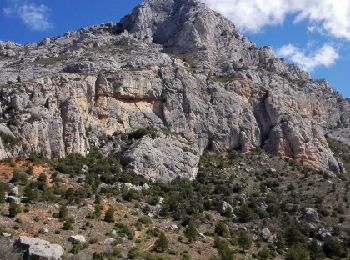
• Sommet Croix de Provence Montagne emblématique de Provence, la Sainte-Victoire s’impose majestueusement au-dessus des...

Trail Walking Saint-Antonin-sur-Bayon - de la maison de Ste Victoire à l'ermitage de St Ser en passant par le pas de la torque - Photo
Walking 8.781
Km
GUIDE

Walking

Medium
Saint-Antonin-sur-Bayon, Provence-Alpes-Côte d'Azur, Bouches-du-Rhône, France
8.8 km | 16.3 km-effort
6h 17min
557 m
596 m
No
amiral13

Trail Walking Saint-Antonin-sur-Bayon - Le Garagaï-Ste Victoire-04-05-22 - Photo
Walking 11.696
Km

Walking

Difficult
Saint-Antonin-sur-Bayon, Provence-Alpes-Côte d'Azur, Bouches-du-Rhône, France
11.7 km | 21 km-effort
4h 31min
704 m
703 m
Yes
Christiancordin

Trail Walking Saint-Antonin-sur-Bayon - sainte victoire - Photo
Walking 10.19
Km

Walking

Very difficult
Saint-Antonin-sur-Bayon, Provence-Alpes-Côte d'Azur, Bouches-du-Rhône, France
10.2 km | 20 km-effort
4h 56min
749 m
749 m
Yes
EricLucchesi

Trail Walking Saint-Antonin-sur-Bayon - La Ste Victoire - Photo
Walking 8.496
Km

Walking

Difficult
Saint-Antonin-sur-Bayon, Provence-Alpes-Côte d'Azur, Bouches-du-Rhône, France
8.5 km | 19.5 km-effort
6h 8min
827 m
825 m
Yes
cousam

Trail Walking Saint-Antonin-sur-Bayon - le refuge Cézanne au départ de la maison de Provence - Photo
Walking 5.832
Km
GUIDE

Walking

Easy
Saint-Antonin-sur-Bayon, Provence-Alpes-Côte d'Azur, Bouches-du-Rhône, France
5.8 km | 9.6 km-effort
2h 9min
281 m
280 m
Yes
amiral13

Trail Walking Saint-Antonin-sur-Bayon - Le garagai  retour pas le pas du moine et le pas du berger - Photo
Walking 6.744
Km

Walking

Difficult
Saint-Antonin-sur-Bayon, Provence-Alpes-Côte d'Azur, Bouches-du-Rhône, France
6.7 km | 14.9 km-effort
4h 18min
613 m
608 m
Yes
Vero7684

Trail Walking Saint-Antonin-sur-Bayon - le Garagai, signal  - Photo
Walking 6.787
Km

Walking

Difficult
Saint-Antonin-sur-Bayon, Provence-Alpes-Côte d'Azur, Bouches-du-Rhône, France
6.8 km | 14.1 km-effort
3h 38min
549 m
561 m
Yes
nadd73

Trail Walking Saint-Antonin-sur-Bayon - la croix de Provence - Photo
Walking 6.642
Km

Walking

Difficult
Saint-Antonin-sur-Bayon, Provence-Alpes-Côte d'Azur, Bouches-du-Rhône, France
6.6 km | 14.7 km-effort
5h 11min
607 m
608 m
Yes
nadd73

Trail Walking Saint-Antonin-sur-Bayon - croix de PROVENCE par le sud - Photo
Walking 8.266
Km

Walking

Easy
Saint-Antonin-sur-Bayon, Provence-Alpes-Côte d'Azur, Bouches-du-Rhône, France
8.3 km | 16.6 km-effort
3h 57min
623 m
625 m
Yes
dlenaour56

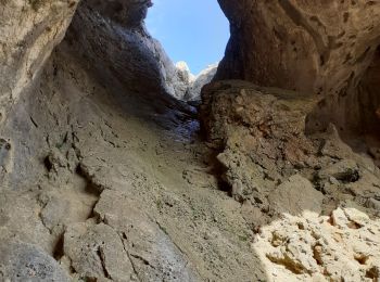
• Pas de l'escalette, croix de PROVENCE et gouffre À/R

Trail Walking Saint-Antonin-sur-Bayon - Tour de la Sainte Victoire - Photo
Walking 20.272
Km

Walking

Medium
(1)
Saint-Antonin-sur-Bayon, Provence-Alpes-Côte d'Azur, Bouches-du-Rhône, France
20 km | 40 km-effort
8h 0min
1484 m
1478 m
Yes
Baltykatt

Trail Walking Saint-Antonin-sur-Bayon - ste victoire pas du clapier col vauvanargues - Photo
Walking 10.521
Km

Walking

Difficult
Saint-Antonin-sur-Bayon, Provence-Alpes-Côte d'Azur, Bouches-du-Rhône, France
10.5 km | 18.8 km-effort
5h 36min
620 m
622 m
Yes
domol

Trail Walking Saint-Antonin-sur-Bayon - la ste  Victoire par le pas de la savonette - Photo
Walking 8.537
Km

Walking

Difficult
Saint-Antonin-sur-Bayon, Provence-Alpes-Côte d'Azur, Bouches-du-Rhône, France
8.5 km | 16.3 km-effort
4h 41min
581 m
583 m
Yes
Elidabeth

Trail Walking Saint-Antonin-sur-Bayon - 13 Canteline - Photo
Walking 6.702
Km

Walking

Very difficult
Saint-Antonin-sur-Bayon, Provence-Alpes-Côte d'Azur, Bouches-du-Rhône, France
6.7 km | 13.5 km-effort
6h 7min
509 m
509 m
Yes
phidge

Trail Walking Saint-Antonin-sur-Bayon - Grande rando Enchois - Pic des Mouches - Photo
Walking 17.608
Km

Walking

Very difficult
(1)
Saint-Antonin-sur-Bayon, Provence-Alpes-Côte d'Azur, Bouches-du-Rhône, France
17.6 km | 35 km-effort
7h 0min
1311 m
1311 m
Yes
tracegps

Trail Walking Saint-Antonin-sur-Bayon - La Sainte-Victoire par la brèche du Clapier - Photo
Walking 9.715
Km

Walking

Very difficult
Saint-Antonin-sur-Bayon, Provence-Alpes-Côte d'Azur, Bouches-du-Rhône, France
9.7 km | 19.2 km-effort
5h 30min
713 m
712 m
Yes
ARVIEU

20 trails displayed on 211

FREE GPS app for hiking

Logo SityTrail SityTrail

IGN / Geographical institutes

Download SityTrail from the App Store Download SityTrail from Google Play

Logo SityTrail SityTrail World

The world is yours!

Download SityTrail from the App Store Download SityTrail from Google Play Download SityTrail on Huawei AppGallery

Activities

Close
My subscriptions