Trail Walking Lucenay - Lucenay (69) - 9 km/D. 293 m - Photo

Lucenay (69) - 9 km/D. 293 m

© OpenStreetMap contributors
Length
Length
8.8 km
Max alt
Max alt
392 m
Uphill gradient
Uphill gradient
292 m
Km-Effort
Km-Effort  
12.7 km
Min alt
Min alt
210 m
Downhill gradient
Downhill gradient
292 m
Boucle
Boucle
Yes
Creation date :
2021-03-11 08:51:12.0
Updated on :
2021-03-11 15:27:34.375

(0 Reviews)

Walking
Walking
2h50
Difficulty : Unknown

Scan this QR Code to open this trail in the SityTrail application

FREE GPS app for hiking

Logo SityTrail SityTrail

IGN / Geographical institutes

Download SityTrail from the App Store Download SityTrail from Google Play

Logo SityTrail SityTrail World

The world is yours!

Download SityTrail from the App Store Download SityTrail from Google Play Download SityTrail on Huawei AppGallery

About

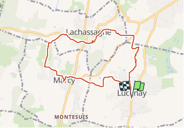
Trail Walking of 8.8 km to be discovered at Auvergne-Rhône-Alpes, Rhône, Lucenay. This trail is proposed by Thomasdanielle.

Description

D/A : Parking de la mairie
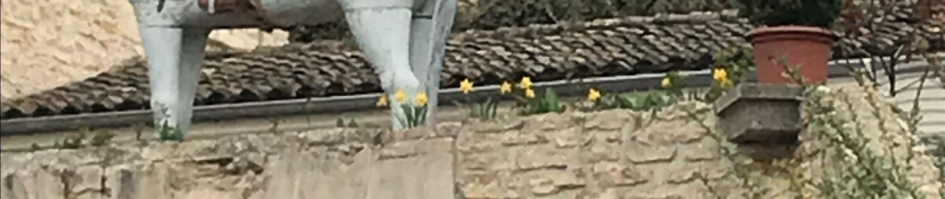
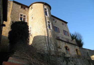
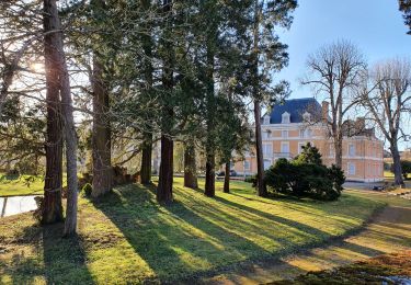
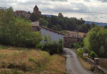
A Marcy  ne pas passer à côté des magnifiques mûrs peints (photos ci-jointes)

Elevation profile

Photos

Positioning

Country:
France
Region :
Auvergne-Rhône-Alpes
Department/Province :
Rhône
Municipality :
Lucenay
Location:
Unknown
Start:(UTM)
631969 ; 5085570 (31T) N.

Trails nearby

Trail On foot Saint-Jean-des-Vignes - De Bagnols à Lozanne - Photo
On foot
PRO

On foot

Easy
Saint-Jean-des-Vignes, Auvergne-Rhône-Alpes, Rhône, France
4 km | 5 km-effort
1h 7min
No
Trail Walking Saint-Jean-des-Vignes - A_ST JEAN DES VIGNES 69380 Pierre Folle - Fontainebleau - Photo
Walking
ANDREJAC

Walking

Easy
(1)
Saint-Jean-des-Vignes, Auvergne-Rhône-Alpes, Rhône, France
8 km | 11 km-effort
3h 0min
Yes
Trail Walking Morancé - morance - Photo
Walking
6974gros

Walking

Very easy
(1)
Morancé, Auvergne-Rhône-Alpes, Rhône, France
7.9 km | 9.7 km-effort
1h 46min
Yes
Trail Horseback riding Les Chères - 5 nov formation - Photo
Horseback riding
HOUDA DRIF

Horseback riding

Easy
(2)
Les Chères, Auvergne-Rhône-Alpes, Rhône, France
13.6 km | 15 km-effort
1h 58min
Yes
Trail Walking Charnay - Charnay (12 km - D. 330 m) - Photo
Walking
Thomasdanielle

Walking

Easy
Charnay, Auvergne-Rhône-Alpes, Rhône, France
12.5 km | 16.9 km-effort
3h 7min
Yes
Trail On foot Chazay-d'Azergues - Tour des Pierres Dorées en Beaujolais - Photo
On foot
PRO

On foot

Easy
Chazay-d'Azergues, Auvergne-Rhône-Alpes, Rhône, France
7.6 km | 10.2 km-effort
2h 19min
No
Trail Walking Châtillon - Châtillon - La vallée de l'Azergues - Photo
Walking
Sigmut

Walking

Easy
Châtillon, Auvergne-Rhône-Alpes, Rhône, France
4.2 km | 5.5 km-effort
1h 33min
Yes
Trail Walking Saint-Jean-des-Vignes - Saint-Jean-des-Vignes - De Saint-Jean à Pierre Folle - Photo
Walking
Sigmut

Walking

Easy
Saint-Jean-des-Vignes, Auvergne-Rhône-Alpes, Rhône, France
3.3 km | 4.2 km-effort
1h 19min
Yes
Trail Walking Saint-Jean-des-Vignes - Bouche de Saint Jean des Vignes à Saint Pierre - Photo
Walking
LBarel

Walking

Easy
Saint-Jean-des-Vignes, Auvergne-Rhône-Alpes, Rhône, France
6.3 km | 8.5 km-effort
2h 2min
Yes


Close
My subscriptions