Trail Walking Charnay - Charnay (12 km - D. 330 m) - Photo

Charnay (12 km - D. 330 m)

© OpenStreetMap contributors
Length
Length
12.5 km
Max alt
Max alt
445 m
Uphill gradient
Uphill gradient
329 m
Km-Effort
Km-Effort  
16.9 km
Min alt
Min alt
212 m
Downhill gradient
Downhill gradient
330 m
Boucle
Boucle
Yes
Creation date :
2023-03-09 13:06:03.0
Updated on :
2023-03-11 10:31:48.487

(0 Reviews)

Walking
Walking
3h07
Difficulty : Easy

Scan this QR Code to open this trail in the SityTrail application

FREE GPS app for hiking

Logo SityTrail SityTrail

IGN / Geographical institutes

Download SityTrail from the App Store Download SityTrail from Google Play

Logo SityTrail SityTrail World

The world is yours!

Download SityTrail from the App Store Download SityTrail from Google Play Download SityTrail on Huawei AppGallery

About

Trail Walking of 12.5 km to be discovered at Auvergne-Rhône-Alpes, Rhône, Charnay. This trail is proposed by Thomasdanielle.

Description

D/A : Parking centre proche de l'impasse Bellevue
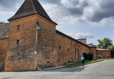
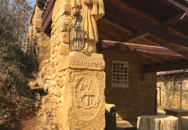
Très belle et intéressante randonnée, passage au centre de Chatillon d'Azergues, son Château fort et son église. (voir les photos)
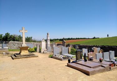
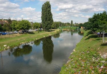
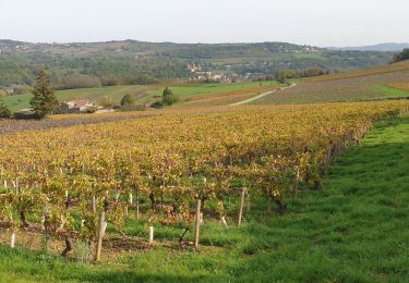
Elevation profile

Photos

Positioning

Country:
France
Region :
Auvergne-Rhône-Alpes
Department/Province :
Rhône
Municipality :
Charnay
Location:
Unknown
Start:(UTM)
629377 ; 5083345 (31T) N.

Trails nearby

Trail Mountain bike Lozanne - La 5ème Vélozannaise (2014-VTT-45km) - Lozanne - Photo
Mountain bike
tracegps

Mountain bike

Difficult
(1)
Lozanne, Auvergne-Rhône-Alpes, Rhône, France
45 km | 59 km-effort
3h 45min
Yes
Trail On foot Saint-Jean-des-Vignes - De Bagnols à Lozanne - Photo
On foot
PRO

On foot

Easy
Saint-Jean-des-Vignes, Auvergne-Rhône-Alpes, Rhône, France
4 km | 5 km-effort
1h 7min
No
Trail On foot Lozanne - De Lozanne à Marcy - Photo
On foot
PRO

On foot

Easy
Lozanne, Auvergne-Rhône-Alpes, Rhône, France
12.2 km | 15.6 km-effort
3h 32min
No
Trail Nordic walking Bagnols - bagnol - Photo
Nordic walking
isabelle.xavier

Nordic walking

Very easy
(1)
Bagnols, Auvergne-Rhône-Alpes, Rhône, France
6.8 km | 8.4 km-effort
1h 40min
Yes
Trail Walking Saint-Jean-des-Vignes - A_ST JEAN DES VIGNES 69380 Pierre Folle - Fontainebleau - Photo
Walking
ANDREJAC

Walking

Easy
(1)
Saint-Jean-des-Vignes, Auvergne-Rhône-Alpes, Rhône, France
8 km | 11 km-effort
3h 0min
Yes
Trail Walking Morancé - morance - Photo
Walking
6974gros

Walking

Very easy
(1)
Morancé, Auvergne-Rhône-Alpes, Rhône, France
7.9 km | 9.7 km-effort
1h 46min
Yes
Trail Walking Chessy - Chessy à Bagnols - Photo
Walking
Jean-Marc C

Walking

Difficult
(1)
Chessy, Auvergne-Rhône-Alpes, Rhône, France
12.5 km | 15.8 km-effort
3h 35min
Yes
Trail Walking Chessy - Chessy - Carrières de Gray - Photo
Walking
PhilDomDoxa

Walking

Very easy
Chessy, Auvergne-Rhône-Alpes, Rhône, France
9.7 km | 13 km-effort
2h 33min
Yes
Trail Walking Chessy - Chessy-Les-Mines - Rhône (15 km - D. 360 m) CV - Photo
Walking
Thomasdanielle

Walking

Medium
(1)
Chessy, Auvergne-Rhône-Alpes, Rhône, France
14.7 km | 19.5 km-effort
4h 9min
Yes


Close
My subscriptions