Trail Walking Mauléon-Barousse - MAULEON-BAROUSSE la boucle des 2 ourses G3 2703781 - Photo

MAULEON-BAROUSSE la boucle des 2 ourses G3 2703781

 marmotte65
marmotte65

User GUIDE

© OpenStreetMap contributors
Length
Length
9.5 km
Max alt
Max alt
802 m
Uphill gradient
Uphill gradient
400 m
Km-Effort
Km-Effort  
14.9 km
Min alt
Min alt
574 m
Downhill gradient
Downhill gradient
403 m
Boucle
Boucle
Yes
Creation date :
2021-03-11 09:15:18.28
Updated on :
2021-03-16 13:31:25.356

(0 Reviews)

Walking
Walking
2h50
Difficulty : Easy

Scan this QR Code to open this trail in the SityTrail application

FREE GPS app for hiking

Logo SityTrail SityTrail

IGN / Geographical institutes

Download SityTrail from the App Store Download SityTrail from Google Play

Logo SityTrail SityTrail World

The world is yours!

Download SityTrail from the App Store Download SityTrail from Google Play Download SityTrail on Huawei AppGallery

About

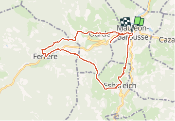
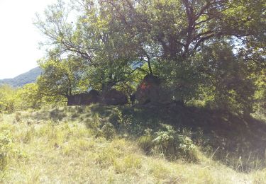
Trail Walking of 9.5 km to be discovered at Occitania, Hautespyrenees, Mauléon-Barousse. This trail is proposed by marmotte65.

Description

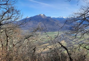
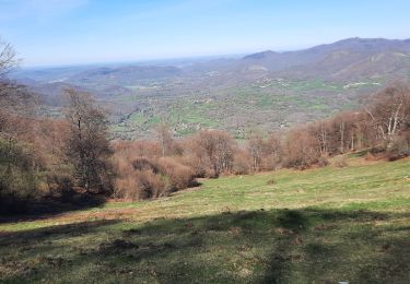
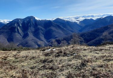
C'est une magnifique balade sans difficulté la traversée de ces villages de  piemont qui sont Mauleon - Ferrere et Ourdé sont offre une délicieuse envie d'en faire le tour. Juste une precaution a prendre .
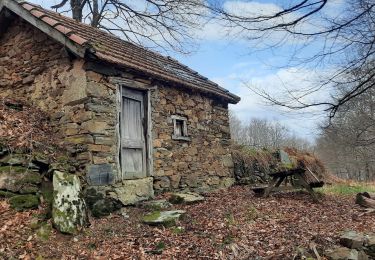
Dans Ferrere une maison est en train de s'effondrée elle est étayée mais il vaut mieux prendre un autre itinéraire dans Ferrere.
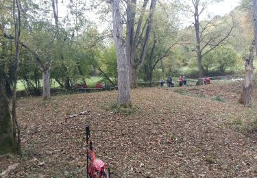
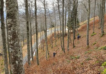
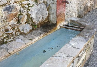
Le PN sera pris au niveau de la traversée  a gué d'un petit ruisseau qui offre suffisemment de plats pour recevoir une quinzaine de personnes
Mais assez de bla bla allez-y .vous m'n direz des nouvelles.

Elevation profile

Photos

Positioning

Country:
France
Region :
Occitania
Department/Province :
Hautespyrenees
Municipality :
Mauléon-Barousse
Location:
Unknown
Start:(UTM)
301587 ; 4759185 (31T) N.

Trails nearby

Trail Walking Antichan - sommet d'Herbe Rouge en boucle depuis Antichan  - Photo
Walking
GUIDE
lhomme.ph

Walking

Medium
Antichan, Occitania, Hautespyrenees, France
11.4 km | 20 km-effort
5h 47min
Yes
Trail Walking Mauléon-Barousse - MAULEON BAROUSSE la rando de Payremilla (G3) faite le 23/10/2020 - Photo
Walking
GUIDE
marmotte65

Walking

Medium
Mauléon-Barousse, Occitania, Hautespyrenees, France
11.6 km | 16.9 km-effort
5h 3min
Yes
Trail Walking Bramevaque - randonnée sur le Touroc depuis Bramevaque  - Photo
Walking
GUIDE
lhomme.ph

Walking

Medium
Bramevaque, Occitania, Hautespyrenees, France
9.3 km | 16.7 km-effort
3h 38min
Yes
Trail Walking Mauléon-Barousse - MAULEON BAROUSSE Circuit des amis du Lac
Walking
GUIDE
marmotte65

Walking

Difficult
Mauléon-Barousse, Occitania, Hautespyrenees, France
11.5 km | 19.1 km-effort
3h 45min
Yes
Trail Walking Ferrère - pic de Douly en boucle depuis Ferrère  - Photo
Walking
GUIDE
lhomme.ph

Walking

Medium
Ferrère, Occitania, Hautespyrenees, France
12.4 km | 25 km-effort
5h 56min
Yes
Trail Walking Sacoué - marrouye depuis le pied du Touroc  - Photo
Walking
GUIDE
lhomme.ph

Walking

Medium
Sacoué, Occitania, Hautespyrenees, France
15 km | 25 km-effort
6h 12min
Yes
Trail On foot Mauléon-Barousse - Mauleon Barousse-Esbareich-Ourde - Photo
On foot
mitch1952

On foot

Very easy
(1)
Mauléon-Barousse, Occitania, Hautespyrenees, France
7.2 km | 11.3 km-effort
3h 0min
Yes
Trail Walking Sacoué - Le Tourroc depuis Sacoué 65 - Photo
Walking
chrisgps

Walking

Easy
Sacoué, Occitania, Hautespyrenees, France
9.5 km | 22 km-effort
5h 5min
Yes
Trail Walking Mauléon-Barousse - Mauléon Esbareich Boucle  - Photo
Walking
GUIDE
lhomme.ph

Walking

Medium
Mauléon-Barousse, Occitania, Hautespyrenees, France
7.5 km | 11.3 km-effort
2h 45min
Yes


Close
My subscriptions