


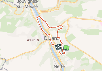


19.3 km | 26 km-effort

User


FREE GPS app for hiking
 SityTrail
IGN / Geographical institutes
SityTrail World
The world is yours!
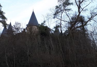
Trail Walking of 5.7 km to be discovered at Wallonia, Namur, Dinant. This trail is proposed by godi.
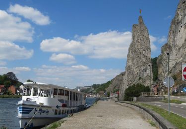
Parcours de 6km au départ de la Montagne de la Croix empruntant une partie du GR versla Citadelle et retour via les rives de la Meuse. Possibilités d'extensions vers Bouvigne et Anseremme.


Walking

Walking
Walking

Walking

Walking
Walking

Walking

Walking
Walking