


Vauvenargues.col de porte.la citadelle.la sinne

mhetpierre
User
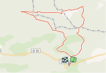

Length
12 km

Max alt
711 m

Uphill gradient
319 m
Km-Effort
16.3 km

Min alt
507 m

Downhill gradient
319 m
Boucle
Yes
Creation date :
2021-03-17 08:54:19.106
Updated on :
2021-03-17 08:55:29.123
3h41
Difficulty : Easy

FREE GPS app for hiking
 SityTrail
IGN / Geographical institutes
SityTrail Plus
The world is yours!
About
Trail On foot of 12 km to be discovered at Provence-Alpes-Côte d'Azur, Bouches-du-Rhône, Vauvenargues. This trail is proposed by mhetpierre.
Positioning
Country:
France
Region :
Provence-Alpes-Côte d'Azur
Department/Province :
Bouches-du-Rhône
Municipality :
Vauvenargues
Location:
Unknown
Start:(Dec)
Start:(UTM)
715266 ; 4825159 (31T) N.
Comments