


Fontfrede -pic des salines par el coll de pois de neu

robertperello
User
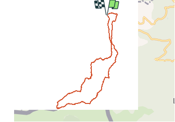

Length
9.8 km

Max alt
1322 m

Uphill gradient
461 m
Km-Effort
16 km

Min alt
962 m

Downhill gradient
474 m
Boucle
Yes
Creation date :
2021-03-17 09:04:00.0
Updated on :
2021-03-17 16:05:38.347
3h34
Difficulty : Difficult

FREE GPS app for hiking
 SityTrail
IGN / Geographical institutes
SityTrail Plus
The world is yours!
About
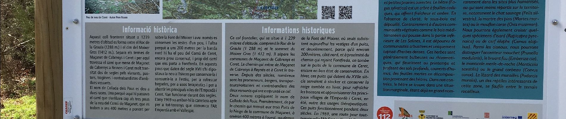
Trail Walking of 9.8 km to be discovered at Occitania, Pyrénées-Orientales, Céret. This trail is proposed by robertperello.
Description
1* partie difficile (rocs)
Photos


Positioning
Country:
France
Region :
Occitania
Department/Province :
Pyrénées-Orientales
Municipality :
Céret
Location:
Unknown
Start:(Dec)
Start:(UTM)
480069 ; 4699563 (31T) N.
Comments