


bievre

maxEA65
User
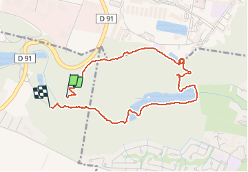

Length
4.3 km

Max alt
171 m

Uphill gradient
60 m
Km-Effort
5.2 km

Min alt
109 m

Downhill gradient
73 m
Boucle
Yes
Creation date :
2021-03-19 13:27:53.5
Updated on :
2021-03-19 14:23:14.448
54m
Difficulty : Very easy

FREE GPS app for hiking
 SityTrail
IGN / Geographical institutes
SityTrail Plus
The world is yours!
About
Trail Walking of 4.3 km to be discovered at Ile-de-France, Yvelines, Guyancourt. This trail is proposed by maxEA65.
Positioning
Country:
France
Region :
Ile-de-France
Department/Province :
Yvelines
Municipality :
Guyancourt
Location:
Unknown
Start:(Dec)
Start:(UTM)
433980 ; 5403013 (31U) N.
Comments
ombragé, un sentier difficile à trouver au dessus de l'étang.