Trail Walking Martigues - Martigues - parc de Figuerolles - Photo
© OpenStreetMap contributors
Length
Length
9.5 km
Max alt
Max alt
141 m
Uphill gradient
Uphill gradient
168 m
Km-Effort
Km-Effort  
11.8 km
Min alt
Min alt
0 m
Downhill gradient
Downhill gradient
168 m
Boucle
Boucle
Yes
Creation date :
2021-03-20 09:51:00.403
Updated on :
2021-03-20 16:36:39.69

(1 Reviews)

Walking
Walking
3h38
Difficulty : Very easy

Scan this QR Code to open this trail in the SityTrail application

FREE GPS app for hiking

Logo SityTrail SityTrail

IGN / Geographical institutes

Download SityTrail from the App Store Download SityTrail from Google Play

Logo SityTrail SityTrail World

The world is yours!

Download SityTrail from the App Store Download SityTrail from Google Play Download SityTrail on Huawei AppGallery

About

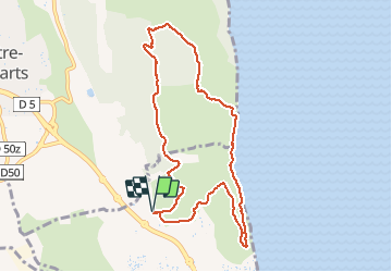
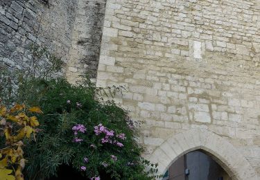
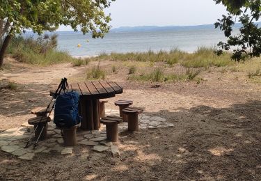
Trail Walking of 9.5 km to be discovered at Provence-Alpes-Côte d'Azur, Bouches-du-Rhône, Martigues. This trail is proposed by mhetpierre.

Description

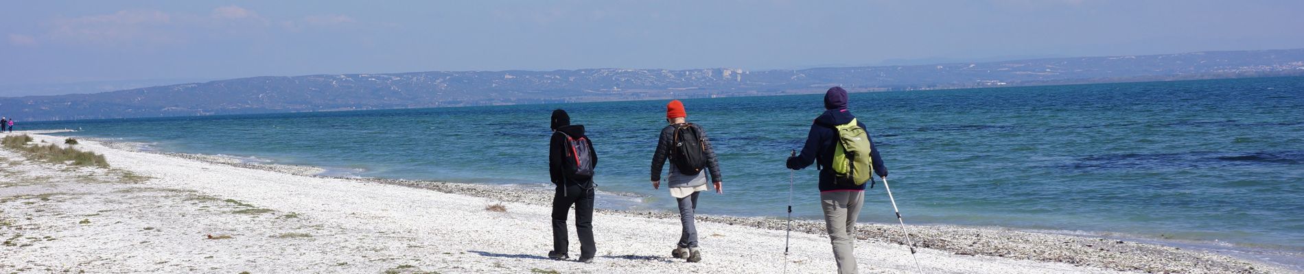
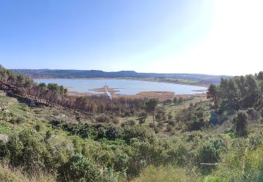
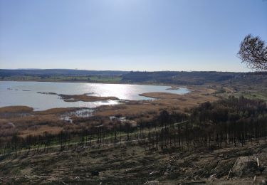
Très beau parcours avec une splendide vue sur l'étang de Berre

Elevation profile

Photos

Positioning

Country:
France
Region :
Provence-Alpes-Côte d'Azur
Department/Province :
Bouches-du-Rhône
Municipality :
Martigues
Location:
Unknown
Start:(UTM)
665235 ; 4811219 (31T) N.

Comments

Please log in to post a review or rate the element


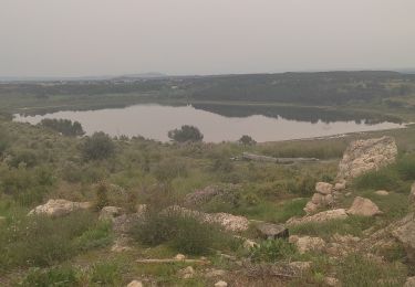
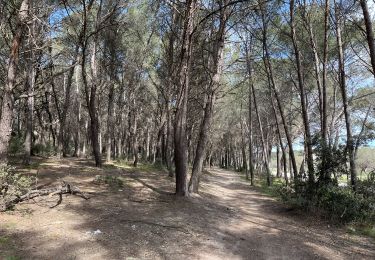
jolie petite randonnée sur les bords de l'étang de Berre au cœur du parc de Figuerolles nous avons effectué un parcours sensiblement plus proche de la mer en suivant le tracé bleu merci pour cette randonnée qui nous a permis de découvrir un nouvel endroit


Trails nearby

Trail On foot Port-de-Bouc - La Presqu’ile - Le sentier du littoral - Photo
On foot
PRO

On foot

Easy
Port-de-Bouc, Provence-Alpes-Côte d'Azur, Bouches-du-Rhône, France
3.9 km | 4.5 km-effort
1h 0min
Yes
Trail On foot Saint-Mitre-les-Remparts - Forêt de Castillon Etang de Saint-Blaise - Photo
On foot
PRO

On foot

Easy
Saint-Mitre-les-Remparts, Provence-Alpes-Côte d'Azur, Bouches-du-Rhône, France
6.1 km | 7.1 km-effort
1h 36min
No
Trail On foot Saint-Mitre-les-Remparts - Entre mer et étangs - Photo
On foot
PRO

On foot

Very difficult
Saint-Mitre-les-Remparts, Provence-Alpes-Côte d'Azur, Bouches-du-Rhône, France
39 km | 46 km-effort
10h 22min
Yes
Trail On foot Saint-Mitre-les-Remparts - Du Crépon aux Rocalèdes - Photo
On foot
PRO

On foot

Easy
Saint-Mitre-les-Remparts, Provence-Alpes-Côte d'Azur, Bouches-du-Rhône, France
6.1 km | 8 km-effort
1h 49min
Yes
Trail On foot Port-de-Bouc - Forêt de Castillon Etangs de Pourra et d’Engrenier - Photo
On foot
PRO

On foot

Easy
Port-de-Bouc, Provence-Alpes-Côte d'Azur, Bouches-du-Rhône, France
6.1 km | 7.7 km-effort
1h 45min
No
Trail On foot Saint-Mitre-les-Remparts - Les Tours Gros - Photo
On foot
PRO

On foot

Easy
Saint-Mitre-les-Remparts, Provence-Alpes-Côte d'Azur, Bouches-du-Rhône, France
6.2 km | 7.9 km-effort
1h 48min
Yes
Trail Walking Saint-Mitre-les-Remparts - Étangs de St Mitre les remparts  - Photo
Walking
nana1643

Walking

Easy
Saint-Mitre-les-Remparts, Provence-Alpes-Côte d'Azur, Bouches-du-Rhône, France
8 km | 9.6 km-effort
3h 36min
No
Trail Walking Istres - Martigues entre les étangs de Citis et Lavalduc - Photo
Walking
jll7513

Walking

Medium
Istres, Provence-Alpes-Côte d'Azur, Bouches-du-Rhône, France
6.9 km | 8.3 km-effort
1h 53min
Yes
Trail Walking Martigues - Figuerrolles - Photo
Walking
sereton

Walking

Easy
Martigues, Provence-Alpes-Côte d'Azur, Bouches-du-Rhône, France
6.1 km | 7.4 km-effort
1h 43min
Yes


Close
My subscriptions