


2203

maxEA65
User
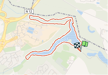

Length
5.7 km

Max alt
166 m

Uphill gradient
73 m
Km-Effort
6.6 km

Min alt
131 m

Downhill gradient
72 m
Boucle
Yes
Creation date :
2021-03-22 09:51:07.56
Updated on :
2021-03-22 10:31:48.279
40m
Difficulty : Very easy

FREE GPS app for hiking
 SityTrail
IGN / Geographical institutes
SityTrail Plus
The world is yours!
About
Trail Walking of 5.7 km to be discovered at Ile-de-France, Yvelines, Guyancourt. This trail is proposed by maxEA65.
Positioning
Country:
France
Region :
Ile-de-France
Department/Province :
Yvelines
Municipality :
Guyancourt
Location:
Unknown
Start:(Dec)
Start:(UTM)
432742 ; 5403636 (31U) N.
Comments