


JFT YB Etape4 30-4-2014

jeff2
User

Length
32 km

Max alt
78 m

Uphill gradient
191 m
Km-Effort
34 km

Min alt
43 m

Downhill gradient
165 m
Boucle
No
Creation date :
2014-12-10 00:00:00.0
Updated on :
2014-12-10 00:00:00.0
7h30
Difficulty : Unknown

FREE GPS app for hiking
 SityTrail
IGN / Geographical institutes
SityTrail Plus
The world is yours!
About
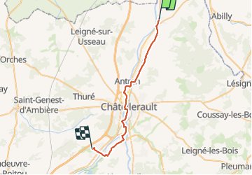
Trail Walking of 32 km to be discovered at New Aquitaine, Vienne, Dangé-Saint-Romain. This trail is proposed by jeff2.
Description
Dange Naintre
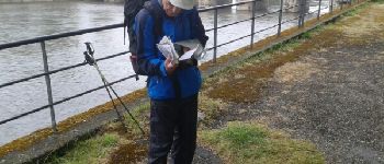
Photos


Positioning
Country:
France
Region :
New Aquitaine
Department/Province :
Vienne
Municipality :
Dangé-Saint-Romain
Location:
Unknown
Start:(Dec)
Start:(UTM)
317782 ; 5200921 (31T) N.
Comments