Trail Walking Barberey-Saint-Sulpice - Montgueux Vignes et champs depuis la D 60 9,1 km - Photo

Montgueux Vignes et champs depuis la D 60 9,1 km

© OpenStreetMap contributors
Length
Length
9.1 km
Max alt
Max alt
271 m
Uphill gradient
Uphill gradient
180 m
Km-Effort
Km-Effort  
11.5 km
Min alt
Min alt
144 m
Downhill gradient
Downhill gradient
180 m
Boucle
Boucle
Yes
Creation date :
2021-03-26 09:09:28.44
Updated on :
2021-03-26 09:10:31.898

(1 Reviews)

Walking
Walking
2h37
Difficulty : Medium

Scan this QR Code to open this trail in the SityTrail application

FREE GPS app for hiking

Logo SityTrail SityTrail

IGN / Geographical institutes

Download SityTrail from the App Store Download SityTrail from Google Play

Logo SityTrail SityTrail World

The world is yours!

Download SityTrail from the App Store Download SityTrail from Google Play Download SityTrail on Huawei AppGallery

About

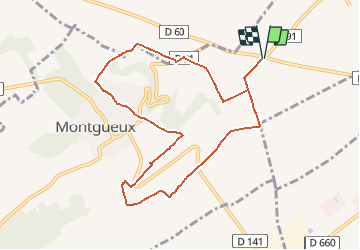
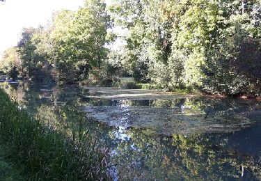
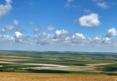
Trail Walking of 9.1 km to be discovered at Grand Est, Aube, Barberey-Saint-Sulpice. This trail is proposed by jacky rahir.

Elevation profile

Positioning

Country:
France
Region :
Grand Est
Department/Province :
Aube
Municipality :
Barberey-Saint-Sulpice
Location:
Unknown
Start:(UTM)
573154 ; 5351581 (31U) N.

Comments

Please log in to post a review or rate the element


Marche à travers les vignes.


Trails nearby

Trail Walking Montgueux - MONTGUEUX, A TRAVERS LES VIGNES, CHAMPS ET BOIS - Photo
Walking
jeannine grandjean

Walking

Medium
(1)
Montgueux, Grand Est, Aube, France
5 km | 6 km-effort
1h 21min
Yes
Trail Nordic walking Saint-André-les-Vergers - sortie Mercredi soir ECH - Photo
Nordic walking
LANDRE0774

Nordic walking

Easy
(1)
Saint-André-les-Vergers, Grand Est, Aube, France
8.8 km | 9.4 km-effort
1h 30min
Yes
Trail Walking Torvilliers - Torvilliers - Photo
Walking
FPortier

Walking

Easy
Torvilliers, Grand Est, Aube, France
7.4 km | 7.9 km-effort
1h 56min
Yes
Trail Walking Barberey-Saint-Sulpice - Barberey - Photo
Walking
Arnaud de Charrin

Walking

Medium
Barberey-Saint-Sulpice, Grand Est, Aube, France
12.9 km | 13.9 km-effort
3h 6min
Yes
Trail Walking Barberey-Saint-Sulpice - Barberey 20,5km le 15-03-2019 - Photo
Walking
francis1952

Walking

Easy
Barberey-Saint-Sulpice, Grand Est, Aube, France
20 km | 22 km-effort
4h 55min
Yes
Trail Walking Barberey-Saint-Sulpice - Barberey voie verte canal de la Haute seine - Photo
Walking
gildascb

Walking

Very easy
Barberey-Saint-Sulpice, Grand Est, Aube, France
9.9 km | 10.5 km-effort
2h 10min
Yes
Trail Walking Montgueux - Montgueux - Photo
Walking
randoam

Walking

Medium
Montgueux, Grand Est, Aube, France
6.4 km | 8.1 km-effort
1h 39min
Yes
Trail Walking Montgueux - Boucle Montgueux  - Photo
Walking
NANE51

Walking

Difficult
(1)
Montgueux, Grand Est, Aube, France
13.3 km | 16.3 km-effort
1h 51min
Yes
Trail Walking Barberey-Saint-Sulpice - Barberey st Lyé Pont canal 17,3km - Photo
Walking
francis1952

Walking

Easy
Barberey-Saint-Sulpice, Grand Est, Aube, France
17.3 km | 18.5 km-effort
3h 21min
Yes


Close
My subscriptions