Trail Walking Annot - Croix de Braux Col de Pelloussis - Photo
© OpenStreetMap contributors
Length
Length
13.4 km
Max alt
Max alt
1369 m
Uphill gradient
Uphill gradient
748 m
Km-Effort
Km-Effort  
23 km
Min alt
Min alt
704 m
Downhill gradient
Downhill gradient
747 m
Boucle
Boucle
Yes
Creation date :
2021-03-28 07:01:57.779
Updated on :
2021-04-20 08:10:45.2

(0 Reviews)

Walking
Walking
7h18
Difficulty : Difficult

Scan this QR Code to open this trail in the SityTrail application

FREE GPS app for hiking

Logo SityTrail SityTrail

IGN / Geographical institutes

Download SityTrail from the App Store Download SityTrail from Google Play

Logo SityTrail SityTrail World

The world is yours!

Download SityTrail from the App Store Download SityTrail from Google Play Download SityTrail on Huawei AppGallery

About

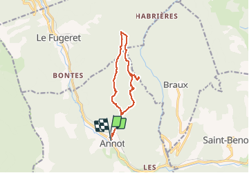
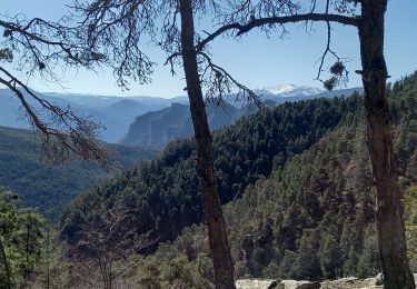
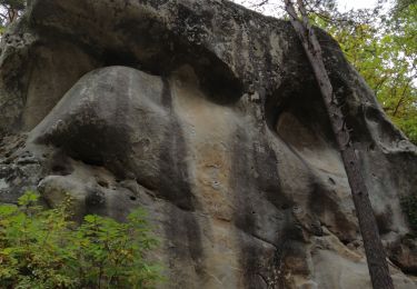
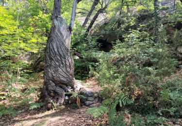
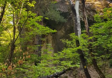
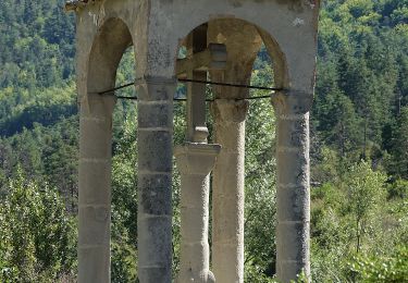
Trail Walking of 13.4 km to be discovered at Provence-Alpes-Côte d'Azur, Alpes-de-Haute-Provence, Annot. This trail is proposed by Marchopier.

Description

Montée par BalmeLonge
Retour par Col de Pelloussis et voie romaine suivant le GTPA

Elevation profile

Photos

Points of interest

Point of interest Annot - Unnamed POI - Photo
Marchopier

Positioning

Country:
France
Region :
Provence-Alpes-Côte d'Azur
Department/Province :
Alpes-de-Haute-Provence
Municipality :
Annot
Location:
Unknown
Start:(UTM)
312810 ; 4870987 (32T) N.

Trails nearby

Trail On foot Annot - Le Grès d'Annot - Photo
On foot
PRO

On foot

Easy
Annot, Provence-Alpes-Côte d'Azur, Alpes-de-Haute-Provence, France
5.9 km | 10.9 km-effort
2h 28min
Yes
Trail Walking Annot - Rando gastro Roncharel - Photo
Walking
Marchopier

Walking

Medium
Annot, Provence-Alpes-Côte d'Azur, Alpes-de-Haute-Provence, France
5.8 km | 11.9 km-effort
2h 42min
No
Trail Walking Annot - Les grès d'Annot - Photo
Walking
Thierryrando06

Walking

Medium
(1)
Annot, Provence-Alpes-Côte d'Azur, Alpes-de-Haute-Provence, France
11.5 km | 19.2 km-effort
6h 2min
Yes
Trail Walking Annot - Rando bleue - Photo
Walking
Marchopier

Walking

Easy
Annot, Provence-Alpes-Côte d'Azur, Alpes-de-Haute-Provence, France
3.9 km | 5.8 km-effort
1h 22min
Yes
Trail Walking Braux - Rando Pieŕre qui tremble Chabrieres Peloussis Argenton  - Photo
Walking
Marchopier

Walking

Medium
Braux, Provence-Alpes-Côte d'Azur, Alpes-de-Haute-Provence, France
14 km | 22 km-effort
6h 27min
Yes
Trail Walking Annot - Grès d'Annot  Carte IGN  3541OT - Photo
Walking
domi06

Walking

Medium
Annot, Provence-Alpes-Côte d'Azur, Alpes-de-Haute-Provence, France
11.3 km | 21 km-effort
7h 23min
Yes
Trail Walking Annot - Les grès d'Annot-20-05-22 - Photo
Walking
Christiancordin

Walking

Medium
Annot, Provence-Alpes-Côte d'Azur, Alpes-de-Haute-Provence, France
6.8 km | 12.4 km-effort
2h 20min
No
Trail Walking Annot - LES GRÈS D'ANNOT - Photo
Walking
michelpaulin

Walking

Medium
Annot, Provence-Alpes-Côte d'Azur, Alpes-de-Haute-Provence, France
5.7 km | 11.1 km-effort
4h 1min
No
Trail On foot Annot - Baou de Parou - Photo
On foot
PRO

On foot

Easy
Annot, Provence-Alpes-Côte d'Azur, Alpes-de-Haute-Provence, France
5.5 km | 11.1 km-effort
2h 31min
Yes


Close
My subscriptions