


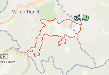

7.3 km | 10.3 km-effort


User


FREE GPS app for hiking
 SityTrail
IGN / Geographical institutes
SityTrail World
The world is yours!
Trail Walking of 10.6 km to be discovered at Provence-Alpes-Côte d'Azur, Maritime Alps, Peymeinade. This trail is proposed by GDE.
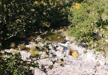
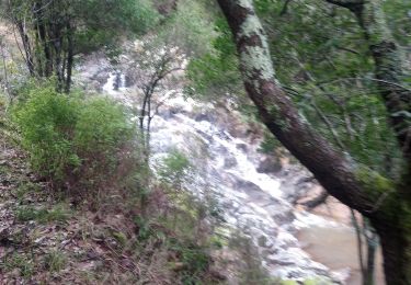
Bien étudier les cartes et estimer les tracés hors piste avant de tenter l'aventure.
On foot

Walking
Walking

On foot

On foot

Mountain bike

Walking

Walking
Mountain bike