


Westhalden Schaùenberg

ROPPJP
User
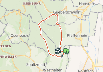

Length
11 km

Max alt
585 m

Uphill gradient
359 m
Km-Effort
15.8 km

Min alt
323 m

Downhill gradient
360 m
Boucle
Yes
Creation date :
2021-04-02 07:14:02.096
Updated on :
2021-04-02 11:20:44.391
3h15
Difficulty : Difficult

FREE GPS app for hiking
 SityTrail
IGN / Geographical institutes
SityTrail Plus
The world is yours!
About
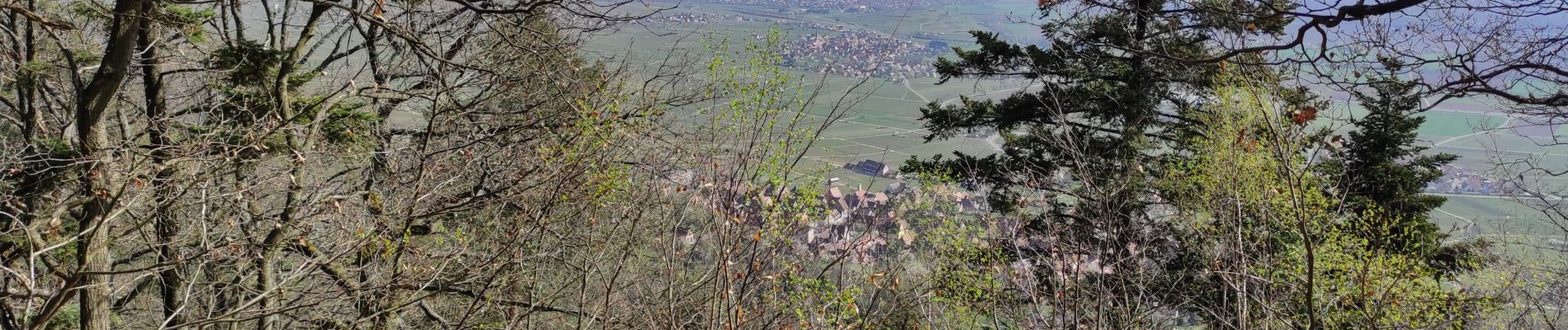
Trail Walking of 11 km to be discovered at Grand Est, Haut-Rhin, Westhalten. This trail is proposed by ROPPJP.
Photos


Positioning
Country:
France
Region :
Grand Est
Department/Province :
Haut-Rhin
Municipality :
Westhalten
Location:
Unknown
Start:(Dec)
Start:(UTM)
370922 ; 5314158 (32T) N.
Comments