


Le grand canon

jmbilger
User

Length
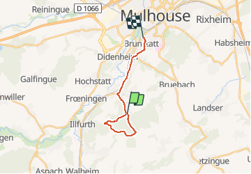
14.1 km

Max alt
409 m

Uphill gradient
210 m
Km-Effort
17.1 km

Min alt
243 m

Downhill gradient
263 m
Boucle
No
Creation date :
2021-04-09 14:04:48.0
Updated on :
2021-04-09 16:34:39.532
1h52
Difficulty : Medium

FREE GPS app for hiking
 SityTrail
IGN / Geographical institutes
SityTrail Plus
The world is yours!
About
Trail Walking of 14.1 km to be discovered at Grand Est, Haut-Rhin, Zillisheim. This trail is proposed by jmbilger.
Positioning
Country:
France
Region :
Grand Est
Department/Province :
Haut-Rhin
Municipality :
Zillisheim
Location:
Unknown
Start:(Dec)
Start:(UTM)
373222 ; 5282211 (32T) N.
Comments