


Boucle de Bissy

Michel_Martin
User
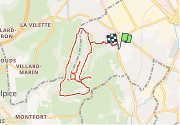

Length
10.1 km

Max alt
478 m

Uphill gradient
313 m
Km-Effort
14.3 km

Min alt
263 m

Downhill gradient
312 m
Boucle
Yes
Creation date :
2021-04-09 11:37:44.809
Updated on :
2021-04-09 17:39:04.249
2h28
Difficulty : Easy

FREE GPS app for hiking
 SityTrail
IGN / Geographical institutes
SityTrail Plus
The world is yours!
About
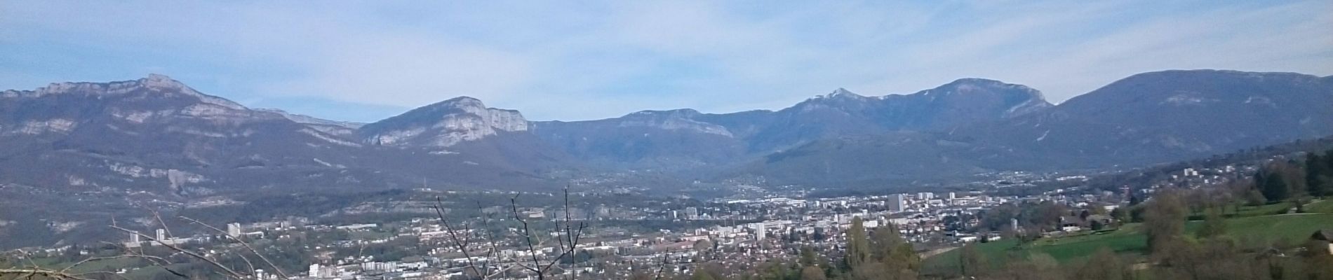
Trail Walking of 10.1 km to be discovered at Auvergne-Rhône-Alpes, Savoy, Chambéry. This trail is proposed by Michel_Martin.
Photos

Positioning
Country:
France
Region :
Auvergne-Rhône-Alpes
Department/Province :
Savoy
Municipality :
Chambéry
Location:
Unknown
Start:(Dec)
Start:(UTM)
725316 ; 5051248 (31T) N.
Comments