


herrlisheim

jcschubnel
User

Length
3.3 km

Max alt
196 m

Uphill gradient
13 m
Km-Effort
3.4 km

Min alt
189 m

Downhill gradient
12 m
Boucle
Yes
Creation date :
2021-04-14 11:49:04.044
Updated on :
2021-04-14 13:51:58.258
1h12
Difficulty : Easy

FREE GPS app for hiking
 SityTrail
IGN / Geographical institutes
SityTrail Plus
The world is yours!
About
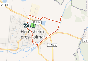
Trail Walking of 3.3 km to be discovered at Grand Est, Haut-Rhin, Herrlisheim-près-Colmar. This trail is proposed by jcschubnel.
Positioning
Country:
France
Region :
Grand Est
Department/Province :
Haut-Rhin
Municipality :
Herrlisheim-près-Colmar
Location:
Unknown
Start:(Dec)
Start:(UTM)
375346 ; 5319805 (32U) N.
Comments