Trail Walking Grignols - sentier historique de Grignols - Photo

sentier historique de Grignols

 fab0202
fab0202

User

© OpenStreetMap contributors
Length
Length
12.7 km
Max alt
Max alt
201 m
Uphill gradient
Uphill gradient
288 m
Km-Effort
Km-Effort  
16.6 km
Min alt
Min alt
73 m
Downhill gradient
Downhill gradient
288 m
Boucle
Boucle
Yes
Creation date :
2021-04-15 08:13:14.566
Updated on :
2021-04-15 11:23:40.402

(0 Reviews)

Walking
Walking
3h00
Difficulty : Easy

Scan this QR Code to open this trail in the SityTrail application

FREE GPS app for hiking

Logo SityTrail SityTrail

IGN / Geographical institutes

Download SityTrail from the App Store Download SityTrail from Google Play

Logo SityTrail SityTrail World

The world is yours!

Download SityTrail from the App Store Download SityTrail from Google Play Download SityTrail on Huawei AppGallery

About

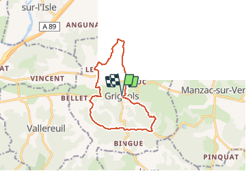
Trail Walking of 12.7 km to be discovered at New Aquitaine, Dordogne, Grignols. This trail is proposed by fab0202.

Description

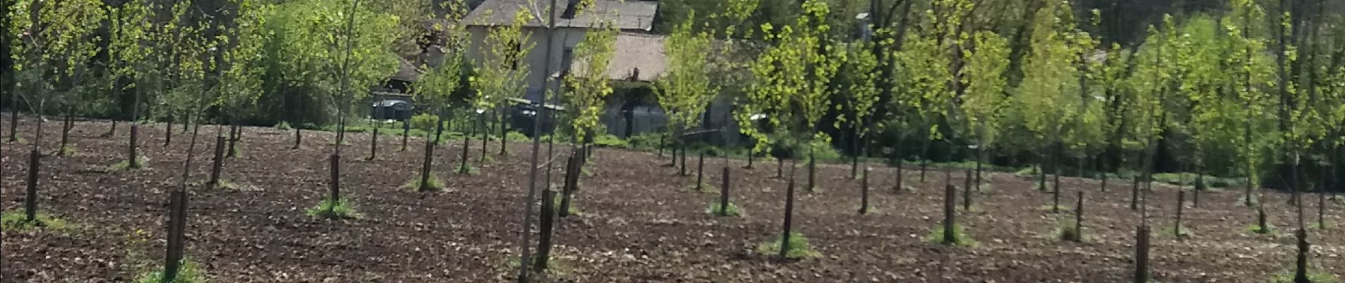
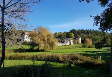
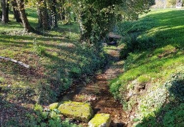
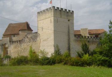
Belle randonnée en sous bois et crêtes avec vue sur château

Elevation profile

Photos

Positioning

Country:
France
Region :
New Aquitaine
Department/Province :
Dordogne
Municipality :
Grignols
Location:
Unknown
Start:(UTM)
306358 ; 4995136 (31T) N.

Trails nearby

Trail Walking Jaure - Petite Boucle Chateau de Jaure  - Photo
Walking
Valerie Vrain

Walking

Easy
Jaure, New Aquitaine, Dordogne, France
4.9 km | 6.2 km-effort
1h 20min
Yes
Trail Walking Jaure - Petite Boucle Chateau de Jaure  - Photo
Walking
Valerie Vrain

Walking

Easy
Jaure, New Aquitaine, Dordogne, France
4.9 km | 6.2 km-effort
1h 20min
Yes
Trail Walking Grignols - boucle bruc grignols - Photo
Walking
fab0202

Walking

Easy
Grignols, New Aquitaine, Dordogne, France
7 km | 9.1 km-effort
1h 49min
Yes
Trail Walking Manzac-sur-Vern - Autour de Manzac sur Vern - Photo
Walking
tracegps

Walking

Difficult
Manzac-sur-Vern, New Aquitaine, Dordogne, France
18 km | 24 km-effort
4h 30min
Yes
Trail On foot Grignols - Boucle des Chaulnes - Photo
On foot
PRO

On foot

Easy
Grignols, New Aquitaine, Dordogne, France
13.2 km | 17.6 km-effort
4h 0min
Yes
Trail On foot Grignols - Sentier historique - Photo
On foot
PRO

On foot

Easy
Grignols, New Aquitaine, Dordogne, France
12.3 km | 16 km-effort
3h 38min
Yes
Trail On foot Bourrou - Boucle de Chante Coucou - Photo
On foot
PRO

On foot

Easy
Bourrou, New Aquitaine, Dordogne, France
8.1 km | 10.5 km-effort
2h 22min
Yes
Trail On foot Bourrou - Boucle du Land'Art - Photo
On foot
PRO

On foot

Easy
Bourrou, New Aquitaine, Dordogne, France
3.4 km | 4.6 km-effort
1h 2min
Yes
Trail Walking Jaure - Jaure en Dordogne  - Photo
Walking
swp648

Walking

Difficult
Jaure, New Aquitaine, Dordogne, France
11.6 km | 14.4 km-effort
2h 42min
Yes


Close
My subscriptions