


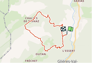
Les Meffins - Col de Spée - Lavouillon - Les Meffins

Kargil
User GUIDE


4h30
Difficulty : Difficult

FREE GPS app for hiking
 SityTrail
IGN / Geographical institutes
SityTrail Plus
The world is yours!
About
Trail Walking of 9.6 km to be discovered at Auvergne-Rhône-Alpes, Upper Savoy, Glières-Val-de-Borne. This trail is proposed by Kargil.
Description
Belle randonnée de la mi-avril.
Descente du col bien enneigée aussi la trace ne suit pas forcément le sentier. Aucune trace entre Tinnaz et Lavouillon.
Un panneau alarmiste "sentier dangereux à vos risques et périls" ne doit pas inquiéter tout randonneur aguerri avec de bonnes chaussures. C'est même un intérêt supplémentaire pour un itinéraire sans difficulté.
Photos

Positioning
Comments