Trail Walking Rogéville - ROGEVILLE - LA PETITE SUISSE PAR MAMEY ET GEZONCOURT - Photo

ROGEVILLE - LA PETITE SUISSE PAR MAMEY ET GEZONCOURT

© OpenStreetMap contributors
Length
Length
23 km
Max alt
Max alt
342 m
Uphill gradient
Uphill gradient
464 m
Km-Effort
Km-Effort  
29 km
Min alt
Min alt
206 m
Downhill gradient
Downhill gradient
463 m
Boucle
Boucle
Yes
Creation date :
2021-04-22 06:38:12.213
Updated on :
2021-04-22 15:35:37.38

(0 Reviews)

Walking
Walking
7h53
Difficulty : Medium

Scan this QR Code to open this trail in the SityTrail application

FREE GPS app for hiking

Logo SityTrail SityTrail

IGN / Geographical institutes

Download SityTrail from the App Store Download SityTrail from Google Play

Logo SityTrail SityTrail World

The world is yours!

Download SityTrail from the App Store Download SityTrail from Google Play Download SityTrail on Huawei AppGallery

About

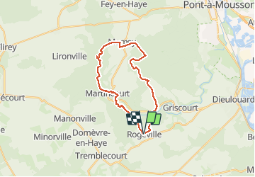
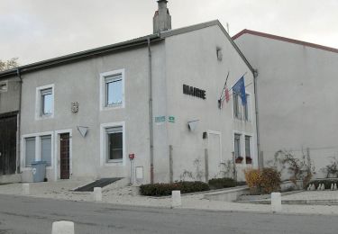
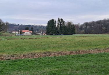
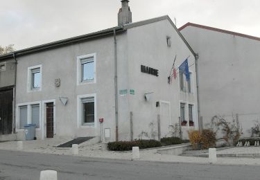
Trail Walking of 23 km to be discovered at Grand Est, Meurthe-et-Moselle, Rogéville. This trail is proposed by jean-marie.parachini.

Description

randonnée à travers la Petite Suisse par les forêts de Rogeville Mamey et Gezoncourt.

Elevation profile

Photos

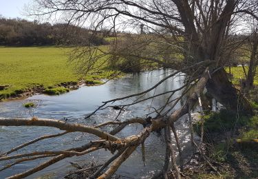
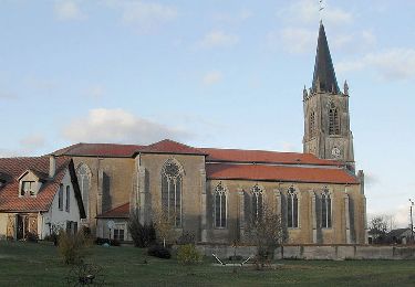
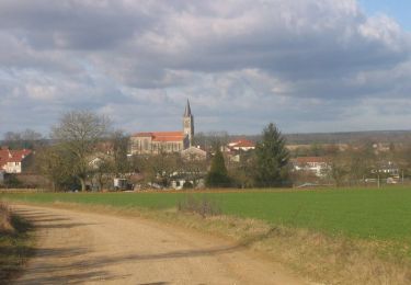
22 photos in total. Please click on a photo to see them all in the gallery.

Positioning

Country:
France
Region :
Grand Est
Department/Province :
Meurthe-et-Moselle
Municipality :
Rogéville
Location:
Unknown
Start:(UTM)
718802 ; 5411697 (31U) N.

Trails nearby

Trail Walking Gézoncourt - GEZONCOURT - PETITE SUISSE LORRAINE - Photo
Walking
jean-marie.parachini

Walking

Very easy
Gézoncourt, Grand Est, Meurthe-et-Moselle, France
8.5 km | 10.3 km-effort
5h 9min
Yes
Trail Equestrian Saizerais - Le Bois St Ignon - Saizerais - Photo
Equestrian
tracegps

Equestrian

Easy
Saizerais, Grand Est, Meurthe-et-Moselle, France
6.9 km | 8 km-effort
1h 15min
Yes
Trail Mountain bike Saizerais - Le Bois St Ignon - Saizerais - Photo
Mountain bike
tracegps

Mountain bike

Easy
Saizerais, Grand Est, Meurthe-et-Moselle, France
6.9 km | 8 km-effort
45min
Yes
Trail Walking Saizerais - Le Bois St Ignon - Saizerais - Photo
Walking
tracegps

Walking

Easy
Saizerais, Grand Est, Meurthe-et-Moselle, France
6.9 km | 8 km-effort
1h 45min
Yes
Trail Equestrian Saizerais - La Cense St Paul - Saizerais - Photo
Equestrian
tracegps

Equestrian

Easy
Saizerais, Grand Est, Meurthe-et-Moselle, France
6.2 km | 7.1 km-effort
1h 0min
Yes
Trail Mountain bike Saizerais - La Cense St Paul - Saizerais - Photo
Mountain bike
tracegps

Mountain bike

Easy
Saizerais, Grand Est, Meurthe-et-Moselle, France
6.2 km | 7.1 km-effort
30min
Yes
Trail Walking Saizerais - La Cense St Paul - Saizerais - Photo
Walking
tracegps

Walking

Easy
Saizerais, Grand Est, Meurthe-et-Moselle, France
6.2 km | 7.1 km-effort
1h 30min
Yes
Trail Walking Martincourt - Martincourt - St Jean - Photo
Walking
jean-marie.parachini

Walking

Easy
Martincourt, Grand Est, Meurthe-et-Moselle, France
11.9 km | 14.7 km-effort
4h 0min
Yes
Trail On foot Rosières-en-Haye - Circuit des 4 Vents - Photo
On foot
PRO

On foot

Easy
Rosières-en-Haye, Grand Est, Meurthe-et-Moselle, France
14.1 km | 15.9 km-effort
3h 36min
Yes


Close
My subscriptions