Trail Walking Grefrath - Grefrath 13,5km - Photo
© OpenStreetMap contributors
Length
Length
13.5 km
Max alt
Max alt
42 m
Uphill gradient
Uphill gradient
87 m
Km-Effort
Km-Effort  
14.6 km
Min alt
Min alt
28 m
Downhill gradient
Downhill gradient
91 m
Boucle
Boucle
Yes
Creation date :
2014-12-10 00:00:00.0
Updated on :
2014-12-10 00:00:00.0

(0 Reviews)

Walking
Walking
--
Difficulty : Unknown

Scan this QR Code to open this trail in the SityTrail application

FREE GPS app for hiking

Logo SityTrail SityTrail

IGN / Geographical institutes

Download SityTrail from the App Store Download SityTrail from Google Play

Logo SityTrail SityTrail World

The world is yours!

Download SityTrail from the App Store Download SityTrail from Google Play Download SityTrail on Huawei AppGallery

About

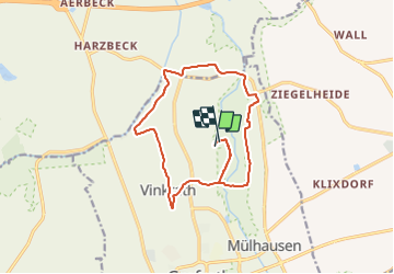
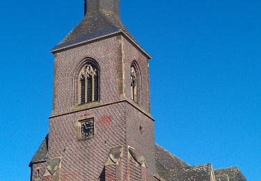
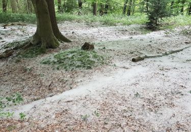
Trail Walking of 13.5 km to be discovered at North Rhine-Westphalia, Kreis Viersen, Grefrath. This trail is proposed by wandelgidszuidlimburg.

Description

More information on : http://www.wandelgidszuidlimburg.com

Elevation profile

Points of interest

Point of interest Grefrath - Start - Photo
wandelgidszuidlimburg
GREFRATH 

Positioning

Country:
Germany
Region :
North Rhine-Westphalia
Department/Province :
Kreis Viersen
Municipality :
Grefrath
Location:
Unknown
Start:(UTM)
315412 ; 5693389 (32U) N.

Trails nearby

Trail On foot Grefrath - Niersauen Runde - Photo
On foot
GUIDE+

On foot

Easy
Grefrath, North Rhine-Westphalia, Kreis Viersen, Germany
3.9 km | 4.1 km-effort
56min
Yes
Trail On foot Kempen - Gottfried-Klinkenberg-Verbindungswege - Photo
On foot
GUIDE+

On foot

Easy
Kempen, North Rhine-Westphalia, Kreis Viersen, Germany
8.3 km | 8.7 km-effort
1h 58min
No
Trail On foot Grefrath - Rundweg A2 Burg Uda - Photo
On foot
GUIDE+

On foot

Easy
Grefrath, North Rhine-Westphalia, Kreis Viersen, Germany
6.6 km | 7.1 km-effort
1h 36min
No
Trail On foot Grefrath - Rundweg A6 Harzbecker Bruch - Photo
On foot
GUIDE+

On foot

Easy
Grefrath, North Rhine-Westphalia, Kreis Viersen, Germany
5.3 km | 5.7 km-effort
1h 18min
Yes
Trail On foot Kempen - Rundweg
On foot
GUIDE+

On foot

Easy
Kempen, North Rhine-Westphalia, Kreis Viersen, Germany
4.2 km | 4.6 km-effort
1h 3min
Yes
Trail On foot Wachtendonk - Rundweg
On foot
GUIDE+

On foot

Easy
Wachtendonk, North Rhine-Westphalia, Kreis Kleve, Germany
3.8 km | 4.1 km-effort
56min
No
Trail On foot Kempen - Gottfried-Klinkenberg-Weg - Photo
On foot
GUIDE+

On foot

Medium
Kempen, North Rhine-Westphalia, Kreis Viersen, Germany
26 km | 28 km-effort
6h 22min
Yes
Trail On foot Nettetal - Rundweg A5 Hinsbecker Höhen - Photo
On foot
GUIDE+

On foot

Easy
Nettetal, North Rhine-Westphalia, Kreis Viersen, Germany
12.5 km | 14.4 km-effort
3h 15min
Yes
Trail On foot Wachtendonk - Wankumer Heide Rundweg A13 - Photo
On foot
GUIDE+

On foot

Easy
Wachtendonk, North Rhine-Westphalia, Kreis Kleve, Germany
4 km | 4.5 km-effort
1h 0min
No


Close
My subscriptions