Trail Walking Nancy - Nancy - parc de Haye -Frouard - Nancy - Photo

Nancy - parc de Haye -Frouard - Nancy

 Toyot 8
Toyot 8

User

© OpenStreetMap contributors
Length
Length
52 km
Max alt
Max alt
386 m
Uphill gradient
Uphill gradient
722 m
Km-Effort
Km-Effort  
61 km
Min alt
Min alt
183 m
Downhill gradient
Downhill gradient
721 m
Boucle
Boucle
Yes
Creation date :
02/05/2021 04:01
Updated on :
02/05/2021 15:51

(0 Reviews)

Walking
Walking
9h02
Difficulty : Medium

Scan this QR Code to open this trail in the SityTrail application

FREE GPS app for hiking

Logo SityTrail SityTrail

IGN / Geographical institutes

Download SityTrail from the App Store Download SityTrail from Google Play

Logo SityTrail SityTrail Plus

The world is yours!

Download SityTrail from the App Store Download SityTrail from Google Play Download SityTrail on Huawei AppGallery

About

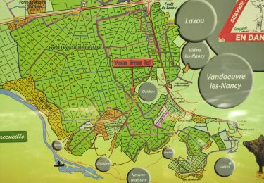
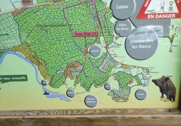
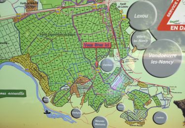
Trail Walking of 52 km to be discovered at Grand Est, Meurthe-et-Moselle, Nancy. This trail is proposed by Toyot 8.

Description

Nancy Clairlieu Parc de Haye Liverdun Fort de Frouard Frouard Champigneulles Nancy

Elevation profile

Photos

Positioning

Country:
France
Region :
Grand Est
Department/Province :
Meurthe-et-Moselle
Municipality :
Nancy
Location:
Unknown
Start:(UTM)
291624 ; 5397230 (32U) N.


Close
My subscriptions