


2021-05-02 16:57:34

mitch1952
User
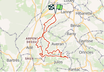

Length
18.6 km

Max alt
643 m

Uphill gradient
492 m
Km-Effort
25 km

Min alt
376 m

Downhill gradient
492 m
Boucle
Yes
Creation date :
2021-05-02 19:23:51.318
Updated on :
2022-06-08 13:27:10.724
5h42
Difficulty : Medium

FREE GPS app for hiking
 SityTrail
IGN / Geographical institutes
SityTrail Plus
The world is yours!
About
Trail On foot of 18.6 km to be discovered at Occitania, Hautespyrenees, Lanne. This trail is proposed by mitch1952.
Description
IBP index 70 toujours selon IBP dénivelée trouvée 575m, prière d' en tenir compte
Positioning
Country:
France
Region :
Occitania
Department/Province :
Hautespyrenees
Municipality :
Lanne
Location:
Unknown
Start:(Dec)
Start:(UTM)
256313 ; 4783360 (31T) N.
Comments