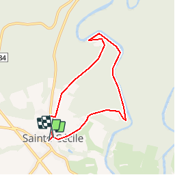
14 km | 18.1 km-effort
Sainte-Cecile door mooie Semoisdal - 7 km RT
wandelroutes
User
Length
6.2 km
Max alt
370 m
Uphill gradient
147 m
Km-Effort
8.1 km
Min alt
278 m
Downhill gradient
149 m
Boucle
Yes
Creation date :
2014-12-10 00:00:00.0
Updated on :
2014-12-10 00:00:00.0
--
Difficulty : Unknown
FREE GPS app for hiking
About
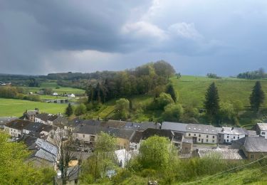
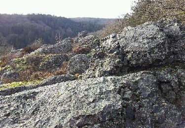
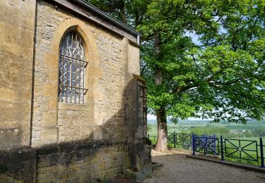
Trail Walking of 6.2 km to be discovered at Wallonia, Luxembourg, Florenville. This trail is proposed by wandelroutes.
Description
More information on : http://www.wandelroutes.org
Positioning
Country:
Belgium
Region :
Wallonia
Department/Province :
Luxembourg
Municipality :
Florenville
Location:
Sainte-Cécile
Start:(Dec)
Start:(UTM)
661574 ; 5510910 (31U) N.
Comments
Trails nearby
14km St Cécile vers Herbeumont
Walking
Medium
(1)
Florenville,
Wallonia,
Luxembourg,
Belgium
2h 56min
Yes
83.631 Muno - Chassepierre
Walking
Medium
(1)
Florenville,
Wallonia,
Luxembourg,
Belgium
11.6 km | 14.1 km-effort
2h 33min
No
Trail Gourmand
Trail
Medium
(2)
Florenville,
Wallonia,
Luxembourg,
Belgium
15.3 km | 21 km-effort
Unknown
Yes
GAUME Circuit vers la Roche a l Appel
Walking
Very easy
(3)
Florenville,
Wallonia,
Luxembourg,
Belgium
7.9 km | 10.8 km-effort
2h 27min
Yes
14. Les Étangs de Conques
On foot
Easy
(1)
Florenville,
Wallonia,
Luxembourg,
Belgium
6.4 km | 8.9 km-effort
2h 0min
No
Walking tour in Florenville
On foot
Easy
Florenville,
Wallonia,
Luxembourg,
Belgium
3.5 km | 3.9 km-effort
53min
Yes
FLORENVILLE
Walking
Easy
(2)
Florenville,
Wallonia,
Luxembourg,
Belgium
12.4 km | 16.5 km-effort
2h 30min
Yes
Chassepierre Florenville - 14 km RT
Walking
Very easy
(3)
Florenville,
Wallonia,
Luxembourg,
Belgium
13.5 km | 16.5 km-effort
Unknown
Yes
Chassepierre photo
Walking
Easy
(2)
Florenville,
Wallonia,
Luxembourg,
Belgium
8.4 km | 10.5 km-effort
4h 0min
Yes
Heel goede app. Een aanrader voor wandelaars.