


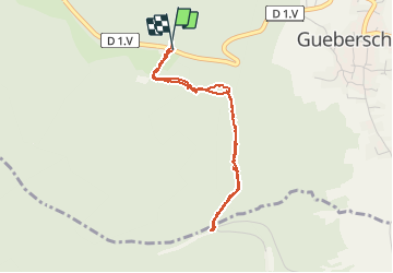
gueberschwihr coucou

jcschubnel
User

Length
3.5 km

Max alt
500 m

Uphill gradient
131 m
Km-Effort
5.3 km

Min alt
428 m

Downhill gradient
138 m
Boucle
Yes
Creation date :
2021-05-07 11:23:31.718
Updated on :
2021-05-07 14:50:17.565
2h30
Difficulty : Easy

FREE GPS app for hiking
 SityTrail
IGN / Geographical institutes
SityTrail Plus
The world is yours!
About
Trail Walking of 3.5 km to be discovered at Grand Est, Haut-Rhin, Gueberschwihr. This trail is proposed by jcschubnel.
Positioning
Country:
France
Region :
Grand Est
Department/Province :
Haut-Rhin
Municipality :
Gueberschwihr
Location:
Unknown
Start:(Dec)
Start:(UTM)
370276 ; 5318208 (32U) N.
Comments