


rando rochehaut 11 /05/2021

japy54
User GUIDE
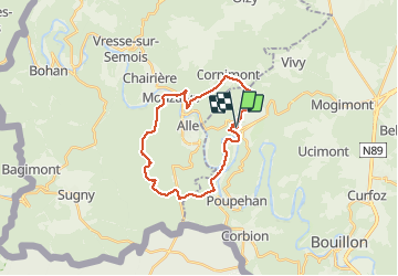

Length
22 km

Max alt
424 m

Uphill gradient
726 m
Km-Effort
32 km

Min alt
184 m

Downhill gradient
728 m
Boucle
Yes
Creation date :
2021-05-11 07:59:01.567
Updated on :
2021-05-11 14:05:03.999
5h31
Difficulty : Difficult

FREE GPS app for hiking
 SityTrail
IGN / Geographical institutes
SityTrail Plus
The world is yours!
About
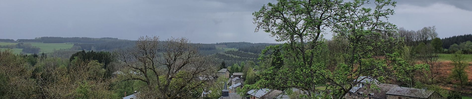
Trail Walking of 22 km to be discovered at Wallonia, Luxembourg, Bouillon. This trail is proposed by japy54.
Photos


Positioning
Country:
Belgium
Region :
Wallonia
Department/Province :
Luxembourg
Municipality :
Bouillon
Location:
Rochehaut
Start:(Dec)
Start:(UTM)
644046 ; 5522891 (31U) N.
Comments