Trail Walking Millery - MILLERY - LA CÔTE DE CREUX - Photo

MILLERY - LA CÔTE DE CREUX

© OpenStreetMap contributors
Length
Length
10.5 km
Max alt
Max alt
407 m
Uphill gradient
Uphill gradient
230 m
Km-Effort
Km-Effort  
13.6 km
Min alt
Min alt
199 m
Downhill gradient
Downhill gradient
235 m
Boucle
Boucle
Yes
Creation date :
2021-05-11 11:52:57.992
Updated on :
2021-05-11 16:47:08.552

(2 Reviews)

Walking
Walking
4h28
Difficulty : Easy

Scan this QR Code to open this trail in the SityTrail application

FREE GPS app for hiking

Logo SityTrail SityTrail

IGN / Geographical institutes

Download SityTrail from the App Store Download SityTrail from Google Play

Logo SityTrail SityTrail World

The world is yours!

Download SityTrail from the App Store Download SityTrail from Google Play Download SityTrail on Huawei AppGallery

About

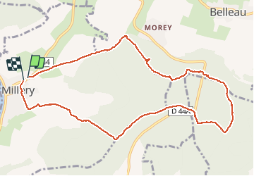
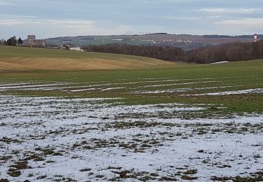
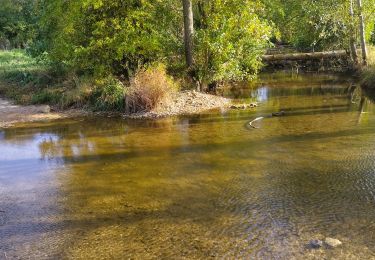
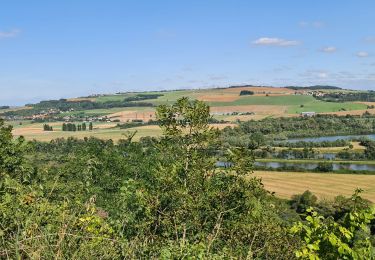
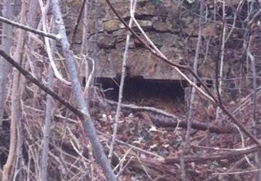
Trail Walking of 10.5 km to be discovered at Grand Est, Meurthe-et-Moselle, Millery. This trail is proposed by jean-marie.parachini.

Description

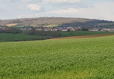
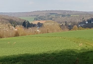
randonnée en forêt entre Millery et Morey.

Elevation profile

Photos

Positioning

Country:
France
Region :
Grand Est
Department/Province :
Meurthe-et-Moselle
Municipality :
Millery
Location:
Unknown
Start:(UTM)
289546 ; 5411327 (32U) N.

Comments

Please log in to post a review or rate the element


belle rando beaux chemins


Trails nearby

Trail Cycle Dieulouard - La petite Suisse Lorraine - Circuit n° 11 - Photo
Cycle
tracegps

Cycle

Medium
(1)
Dieulouard, Grand Est, Meurthe-et-Moselle, France
29 km | 35 km-effort
1h 30min
Yes
Trail On foot Marbache - Circuit de la Vierge de Belleville - Photo
On foot
PRO

On foot

Easy
Marbache, Grand Est, Meurthe-et-Moselle, France
6 km | 8.5 km-effort
1h 55min
Yes
Trail Walking Dieulouard - DIEULOUARD - VERS BELLEVILLE ET SAIZERAIS - Photo
Walking
jean-marie.parachini

Walking

Easy
Dieulouard, Grand Est, Meurthe-et-Moselle, France
13.9 km | 16.7 km-effort
4h 43min
Yes
Trail Walking Marbache - MARBACHE - LA TARTE - Photo
Walking
jean-marie.parachini

Walking

Very easy
Marbache, Grand Est, Meurthe-et-Moselle, France
8.3 km | 10.8 km-effort
3h 15min
Yes
Trail Walking Dieulouard - LA VIERGE DE BELLEVILLE - Photo
Walking
jean-marie.parachini

Walking

Easy
Dieulouard, Grand Est, Meurthe-et-Moselle, France
13.4 km | 16.1 km-effort
3h 19min
Yes
Trail Walking Dieulouard -  Dieulouard  - Photo
Walking
Toyot 8

Walking

Difficult
Dieulouard, Grand Est, Meurthe-et-Moselle, France
11.1 km | 14.1 km-effort
2h 56min
Yes
Trail Walking Dieulouard - Dieulouard - Photo
Walking
jean-marie.parachini

Walking

Easy
Dieulouard, Grand Est, Meurthe-et-Moselle, France
8.5 km | 11.2 km-effort
3h 52min
Yes
Trail Walking Millery - Millery la côte de creux le bois du chapitre - Photo
Walking
jean-marie.parachini

Walking

Easy
Millery, Grand Est, Meurthe-et-Moselle, France
10.2 km | 13.3 km-effort
4h 14min
Yes
Trail Walking Millery - Randonnée 11 km TUCLC 2017 - Photo
Walking
g.chotel

Walking

Medium
Millery, Grand Est, Meurthe-et-Moselle, France
10.5 km | 13.6 km-effort
3h 1min
Yes


Close
My subscriptions