Trail Walking Bouillon - 2021-04-30 15:53:20 - Photo

2021-04-30 15:53:20

© OpenStreetMap contributors
Length
Length
17 km
Max alt
Max alt
390 m
Uphill gradient
Uphill gradient
563 m
Km-Effort
Km-Effort  
24 km
Min alt
Min alt
212 m
Downhill gradient
Downhill gradient
559 m
Boucle
Boucle
Yes
Creation date :
2021-05-15 13:49:19.792
Updated on :
2021-05-15 14:46:04.89

(0 Reviews)

Walking
Walking
5h33
Difficulty : Very difficult

Scan this QR Code to open this trail in the SityTrail application

FREE GPS app for hiking

Logo SityTrail SityTrail

IGN / Geographical institutes

Download SityTrail from the App Store Download SityTrail from Google Play

Logo SityTrail SityTrail Plus

The world is yours!

Download SityTrail from the App Store Download SityTrail from Google Play Download SityTrail on Huawei AppGallery

About

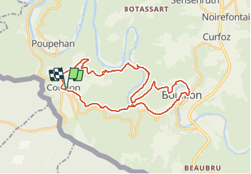
Trail Walking of 17 km to be discovered at Wallonia, Luxembourg, Bouillon. This trail is proposed by Luberon1963.

Description

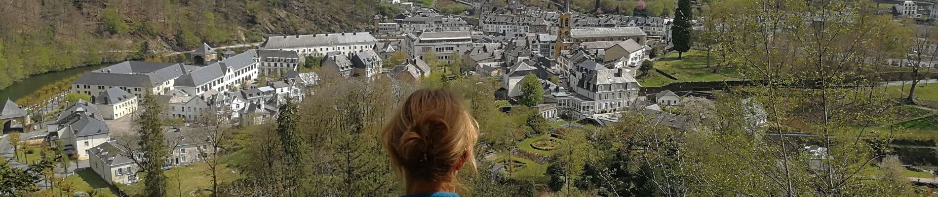
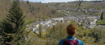
Boucle au départ de Corbion et arrivant sur Bouillon par les hauteurs.
Agréable Randonnée; on traverse la Semois au lieu-dit l'Epine via la toute nouvelle passerelle piétonnière (belle intégration dans le paysage et ouvrage très sérieux) et on passe devant l'abbaye de Clairefontaine (Cordemois).
Beaucoup de paysages intéressants et variés.
Loin d'être extrême, ça reste physique tout de même.

Elevation profile

Photos

Points of interest

Point of interest Bouillon - Passerelle de l'Epine - Photo
Luberon1963
Point of interest Bouillon - Accès Moulin de l'Epine - Photo
Luberon1963
Point of interest Bouillon - Point de vue sur Bouillon - Photo
Luberon1963

Positioning

Country:
Belgium
Region :
Wallonia
Department/Province :
Luxembourg
Municipality :
Bouillon
Location:
Corbion
Start:(UTM)
644681 ; 5517955 (31U) N.


Close
My subscriptions