Trail Walking Collioure - Tour de Madaloc - Photo
© OpenStreetMap contributors
Length
Length
9.1 km
Max alt
Max alt
638 m
Uphill gradient
Uphill gradient
422 m
Km-Effort
Km-Effort  
14.7 km
Min alt
Min alt
327 m
Downhill gradient
Downhill gradient
418 m
Boucle
Boucle
Yes
Creation date :
2021-05-20 07:43:45.751
Updated on :
2021-11-16 12:30:42.754

(0 Reviews)

Walking
Walking
4h24
Difficulty : Medium

Scan this QR Code to open this trail in the SityTrail application

FREE GPS app for hiking

Logo SityTrail SityTrail

IGN / Geographical institutes

Download SityTrail from the App Store Download SityTrail from Google Play

Logo SityTrail SityTrail Plus

The world is yours!

Download SityTrail from the App Store Download SityTrail from Google Play Download SityTrail on Huawei AppGallery

About

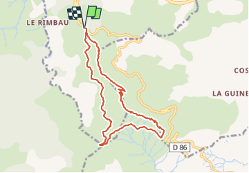
Trail Walking of 9.1 km to be discovered at Occitania, Pyrénées-Orientales, Collioure. This trail is proposed by TOULAUDIN.

Description

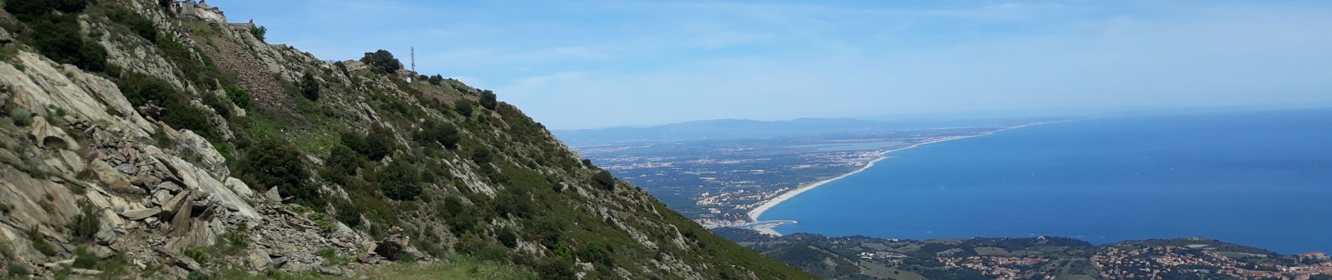
randonnée effectuée le 20/5/21 en partant du Mas de la Serra
quelques places de stationnement pour les voitures (6/7)
montée dans la roche assez raide jusqu'à la batterie Taillefer
ensuite pas de difficultés, pratiquement tout en balcon nous donnant une vue sublime sur la côte. rando à faire en Avril Mai pour bénéficier de la floraison du massif (cistes, lavandes papillon, genêts etc..)c'est féérique.  

Elevation profile

Photos

Positioning

Country:
France
Region :
Occitania
Department/Province :
Pyrénées-Orientales
Municipality :
Collioure
Location:
Unknown
Start:(UTM)
505340 ; 4705838 (31T) N.


Close
My subscriptions