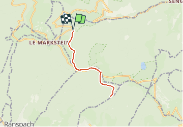
Parking Hofried - Chemin du Hofried - Kapitaenstressla-Refuge du Storkenkopf et retour

patrickbeyrath
User

Length
10.8 km

Max alt
1245 m

Uphill gradient
275 m
Km-Effort
14.4 km

Min alt
1121 m

Downhill gradient
275 m
Boucle
Yes
Creation date :
2021-05-21 06:38:37.424
Updated on :
2021-05-21 06:52:57.767
3h11
Difficulty : Medium

FREE GPS app for hiking
 SityTrail
IGN / Geographical institutes
SityTrail Plus
The world is yours!
About
Trail On foot of 10.8 km to be discovered at Grand Est, Haut-Rhin, Lautenbachzell. This trail is proposed by patrickbeyrath.
Positioning
Country:
France
Region :
Grand Est
Department/Province :
Haut-Rhin
Municipality :
Lautenbachzell
Location:
Unknown
Start:(Dec)
Start:(UTM)
354204 ; 5310220 (32T) N.
Comments