


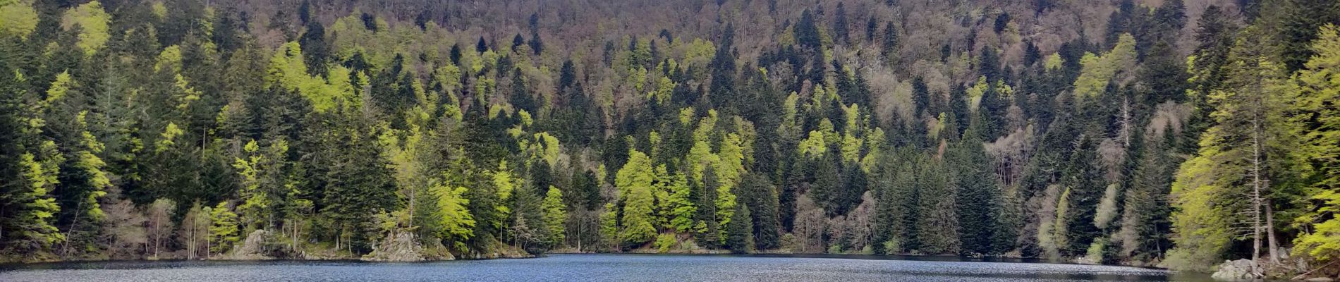
2021-05-23 Marche Mittlach Rothenbachkopf

holtzv
User GUIDE
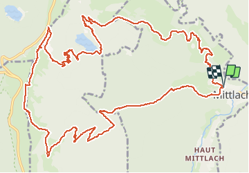

Length
18.1 km

Max alt
1304 m

Uphill gradient
1125 m
Km-Effort
33 km

Min alt
542 m

Downhill gradient
1127 m
Boucle
Yes
Creation date :
2021-05-23 07:50:24.957
Updated on :
2021-05-24 17:41:23.461
7h30
Difficulty : Very difficult

FREE GPS app for hiking
 SityTrail
IGN / Geographical institutes
SityTrail Plus
The world is yours!
About
Trail Walking of 18.1 km to be discovered at Grand Est, Haut-Rhin, Mittlach. This trail is proposed by holtzv.
Photos


Positioning
Country:
France
Region :
Grand Est
Department/Province :
Haut-Rhin
Municipality :
Mittlach
Location:
Unknown
Start:(Dec)
Start:(UTM)
353001 ; 5318744 (32U) N.
Comments