


Le Port de Castet en étoile - G4

mitch1952
User
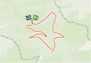

Length
9.5 km

Max alt
1137 m

Uphill gradient
310 m
Km-Effort
13.6 km

Min alt
865 m

Downhill gradient
311 m
Boucle
Yes
Creation date :
2021-05-26 07:56:40.059
Updated on :
2022-06-08 13:45:21.816
4h00
Difficulty : Medium

FREE GPS app for hiking
 SityTrail
IGN / Geographical institutes
SityTrail Plus
The world is yours!
About
Trail Walking of 9.5 km to be discovered at New Aquitaine, Pyrénées-Atlantiques, Castet. This trail is proposed by mitch1952.
Description
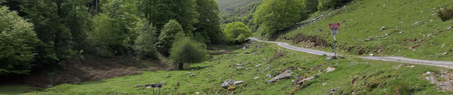
Randonnée sur chemin ombragé en très bon état
Photos

Positioning
Country:
France
Region :
New Aquitaine
Department/Province :
Pyrénées-Atlantiques
Municipality :
Castet
Location:
Unknown
Start:(Dec)
Start:(UTM)
713316 ; 4771181 (30T) N.
Comments