


taennchel rotzel

jcschubnel
User
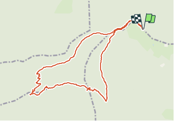

Length
5.5 km

Max alt
959 m

Uphill gradient
277 m
Km-Effort
9.2 km

Min alt
679 m

Downhill gradient
279 m
Boucle
Yes
Creation date :
2021-05-31 11:40:43.695
Updated on :
2021-05-31 16:00:28.72
3h00
Difficulty : Medium

FREE GPS app for hiking
 SityTrail
IGN / Geographical institutes
SityTrail Plus
The world is yours!
About
Trail Walking of 5.5 km to be discovered at Grand Est, Haut-Rhin, Rodern. This trail is proposed by jcschubnel.
Positioning
Country:
France
Region :
Grand Est
Department/Province :
Haut-Rhin
Municipality :
Rodern
Location:
Unknown
Start:(Dec)
Start:(UTM)
372822 ; 5344896 (32U) N.
Comments