


Ares Anderno Ares

mimilolo
User
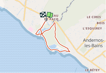

Length
6.7 km

Max alt
13 m

Uphill gradient
40 m
Km-Effort
7.2 km

Min alt
-2 m

Downhill gradient
39 m
Boucle
Yes
Creation date :
2021-06-01 07:41:25.949
Updated on :
2021-06-01 09:48:58.689
1h44
Difficulty : Very easy

FREE GPS app for hiking
 SityTrail
IGN / Geographical institutes
SityTrail Plus
The world is yours!
About
Trail Walking of 6.7 km to be discovered at New Aquitaine, Gironde, Arès. This trail is proposed by mimilolo.
Description
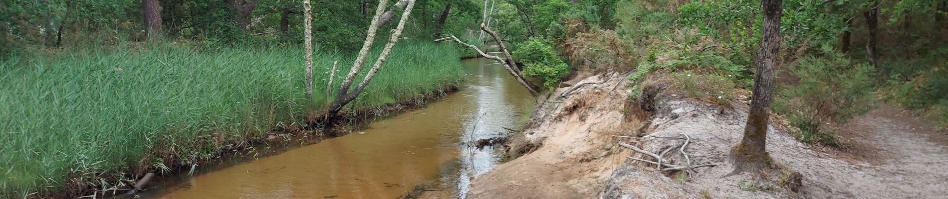
depart residence les Rives de saint Brice ballade par PR et GRP passage en forêt puis bord de mer à Andernos traversée des Cabanes
Photos


Positioning
Country:
France
Region :
New Aquitaine
Department/Province :
Gironde
Municipality :
Arès
Location:
Unknown
Start:(Dec)
Start:(UTM)
648773 ; 4957624 (30T) N.
Comments